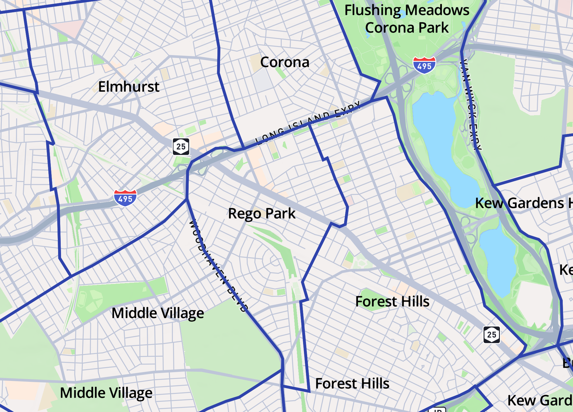
Rego Park is a neighborhood in east-central Queens where I currently live.
Before moving here, I’ve only seen this neighborhood now and then:
We would drive west from our home in Bayside - my father at the wheel, me in the passenger seat with time to watch the streets pass by.
On occasion we would come to Costco at Rego Center.
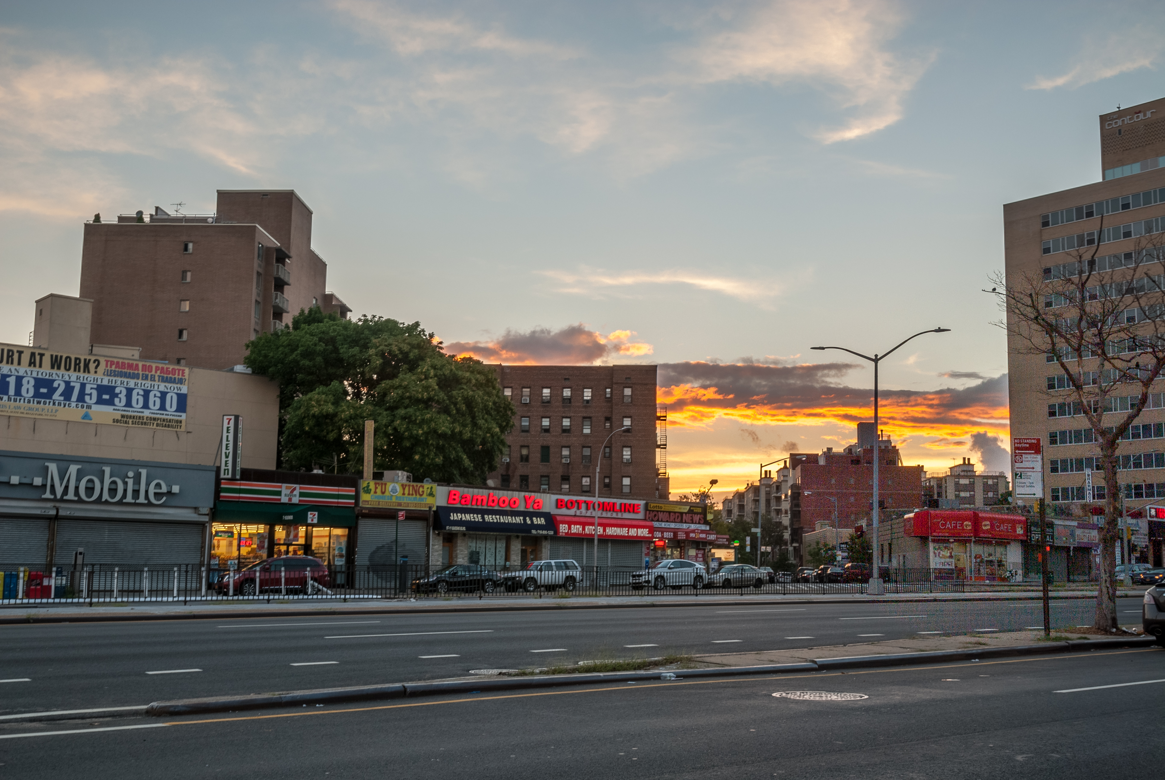
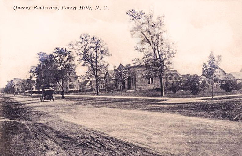
Passing along Queens Boulevard, with the Manhattan skyline visible in the distance, the rows of somewhat faded brick buildings appeared as a uniform whole.
While living here, I’ve become more curious about Rego Park’s past and how it has flowed into the present. This digital tour is my small contribution to that effort - my way of trying to understand the place where I live.
The content on this site is partially adapted, with permission, from the Six To Celebrate pages on this neighborhood.
Early Beginnings
What is now Rego Park was originally part of Whitepot, an area first settled in 1653 by English and Dutch farmers.
The name comes from the Dutch Whiteput, which means “hollow creek.” The original colonists farmed the land and sold their produce to Manhattan.
By the end of the 19th century, Chinese farmers leased the lands and grew their own crops to sell at the markets of Chinatown.
In the 1920s, the Real Good Construction Company bought out the farms and built one-family row houses, multi-family houses, and apartment buildings. Soon, the area was renamed Rego Park (Real Good) after the company.
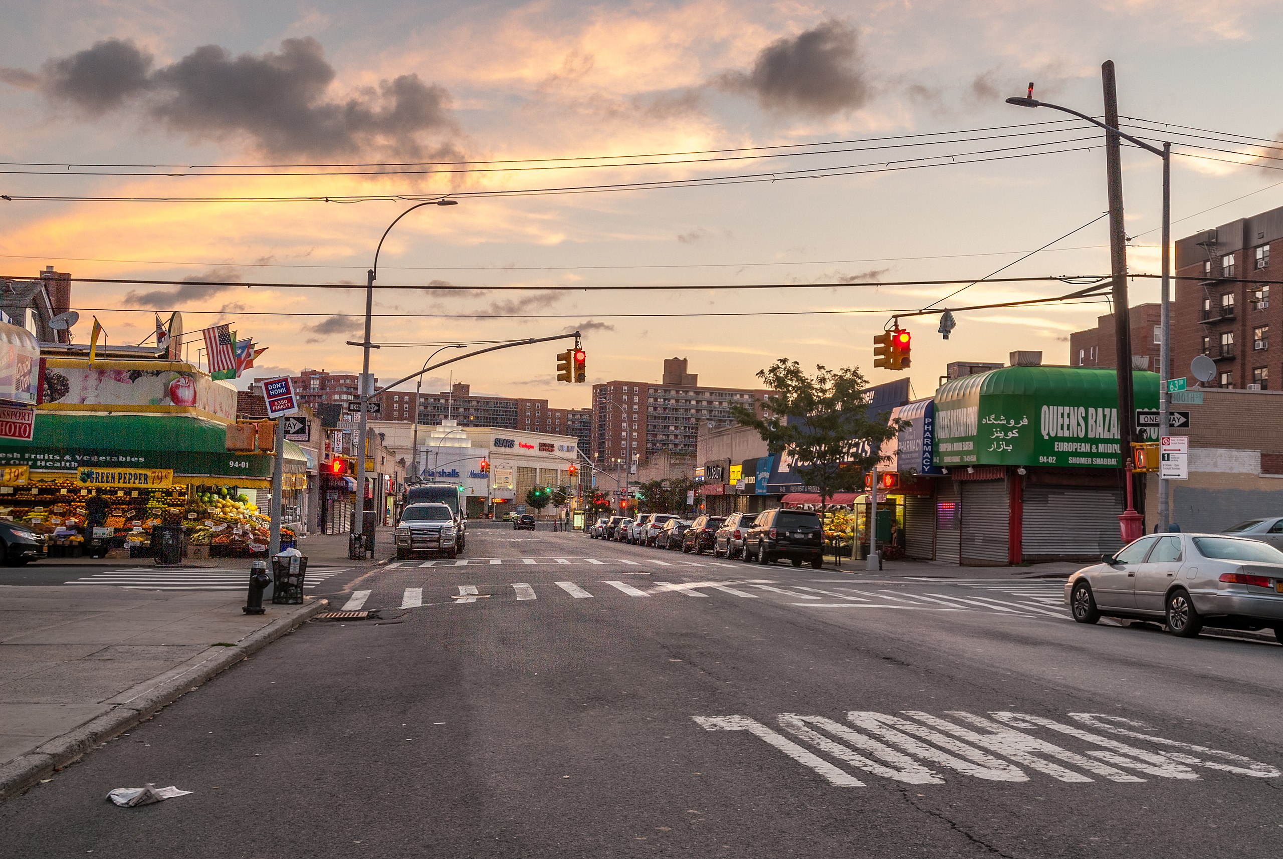
Queens Boulevard is one of the busiest arteries of Rego Park. Many of the neighborhood’s best-known civic and commercial landmarks sit along it.
The area to the south of Queens Boulevard became the heart of early Rego Park development. Here the Real Good Construction Company built its first apartment buildings in the 1920s and 1930s.
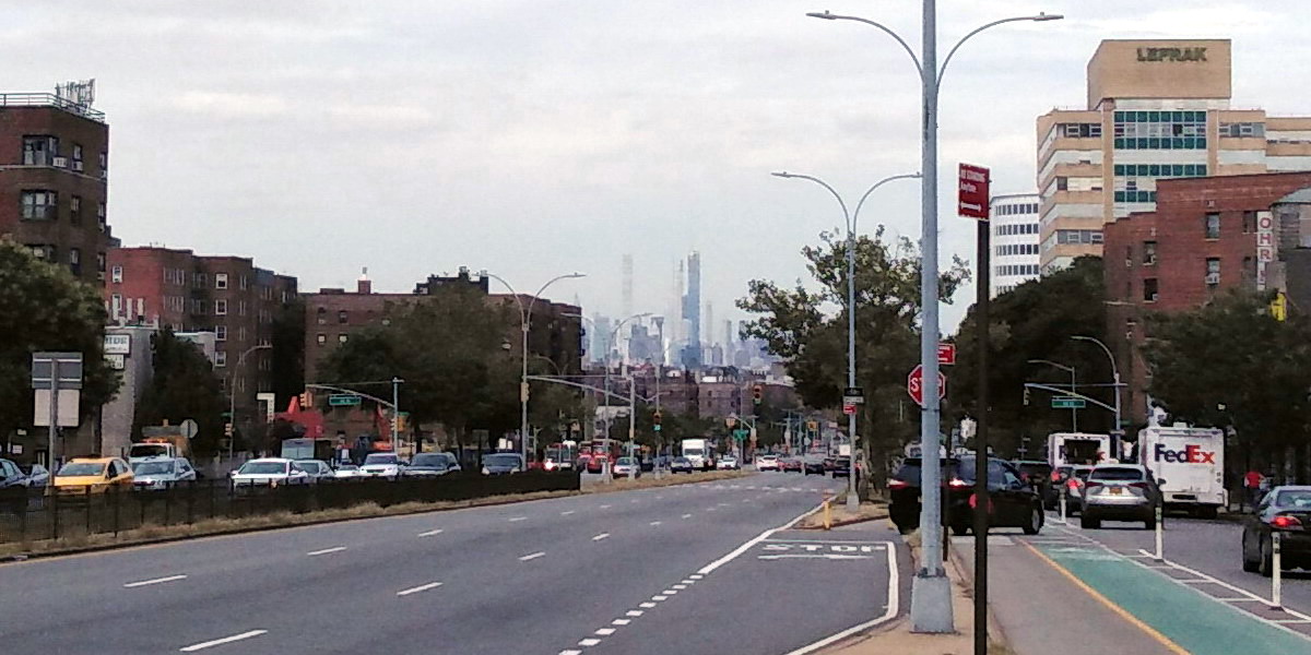
In the early morning, walking down 64th Road, I pass parents guiding kids toward P.S. 139. Queens Boulevard is already stirring with the drift of car traffic and hiss of bus doors.
When the light turns green, I rush across to reach the bus stop in time for the express bus to Manhattan. The city feels far yet close, its skyscrapers faintly visible from the relative elevation of this point.
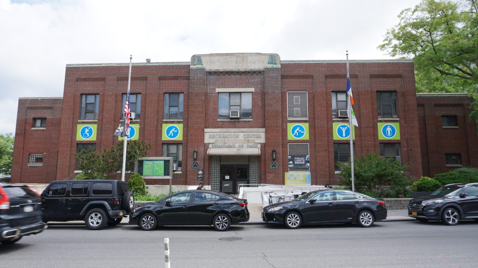
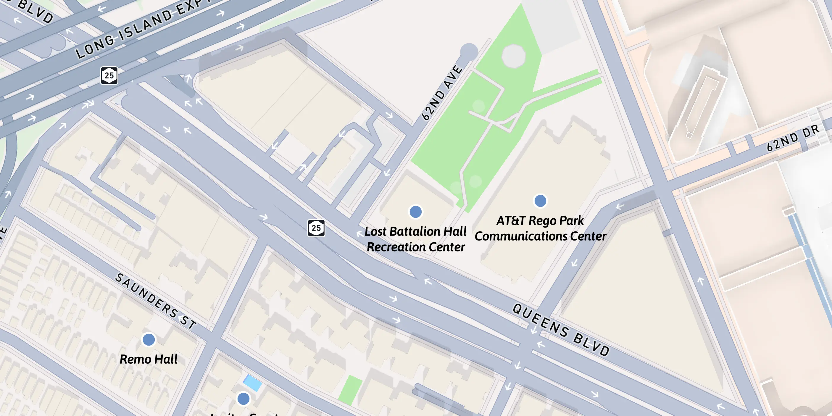
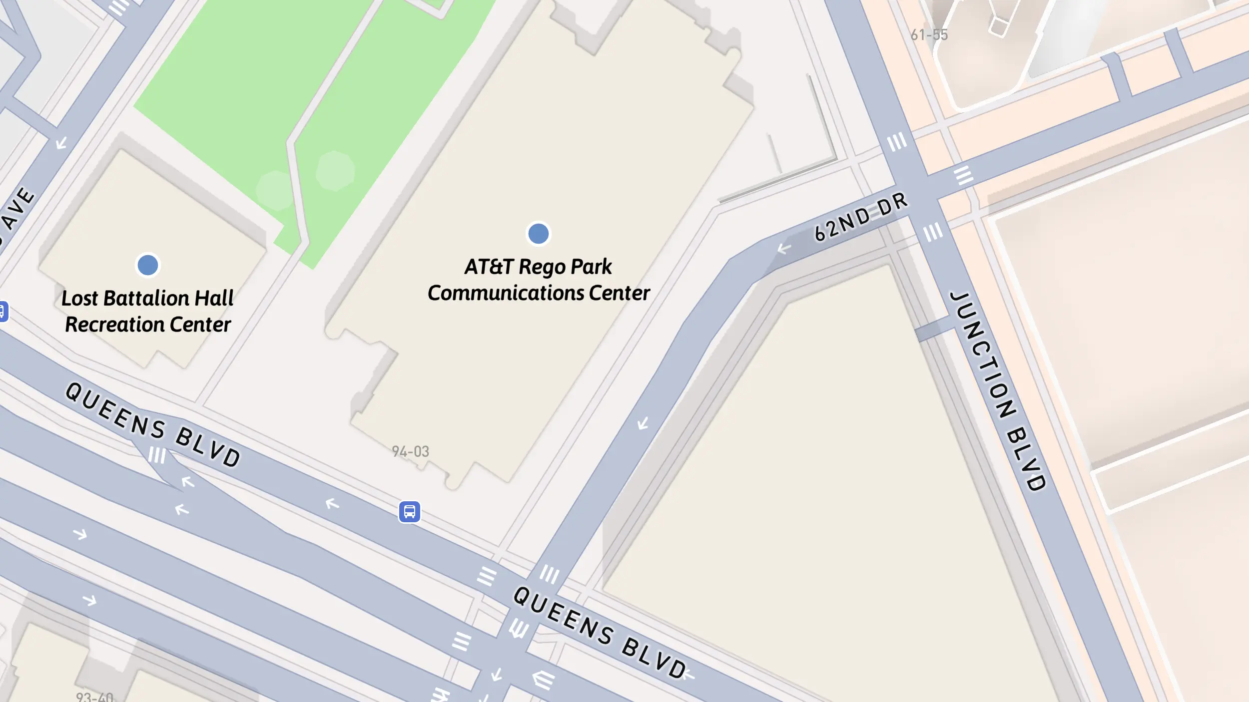
The Lost Battalion Hall Recreation Center is located at the western edge of Rego Park.
In 1938, funding through the Works Progress Administration led to the construction of this two-story Art Moderne building.
It was dedicated to the 77th Division of the U.S. Army for its heroism in the Battle of Argonne in France during World War I.
A limestone inscription was added to the façade, as well as bronze tablets of the Statue of Liberty.
In 1960, the building was placed under the jurisdiction of the Parks Department. The center has served the community as a recreation facility for people of all ages.
The center is currently under reconstruction, with expected completion in December 2025.
Historic Districts Council, Six to Celebrate Rego Park walking tour guide. sixtocelebrate.org
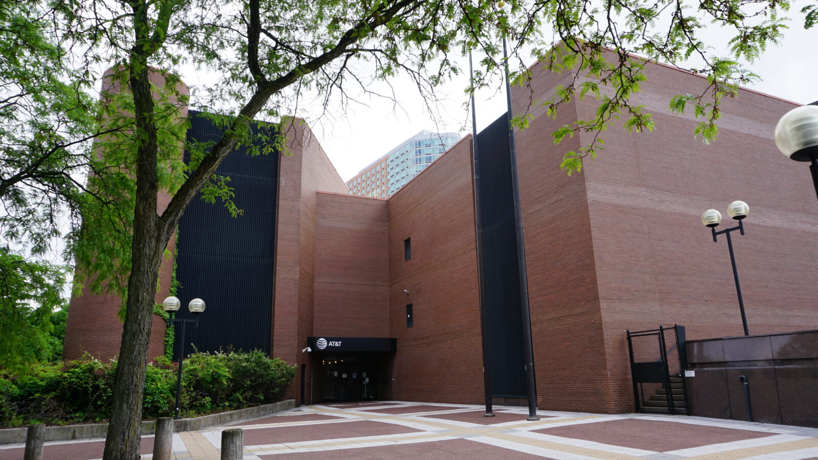
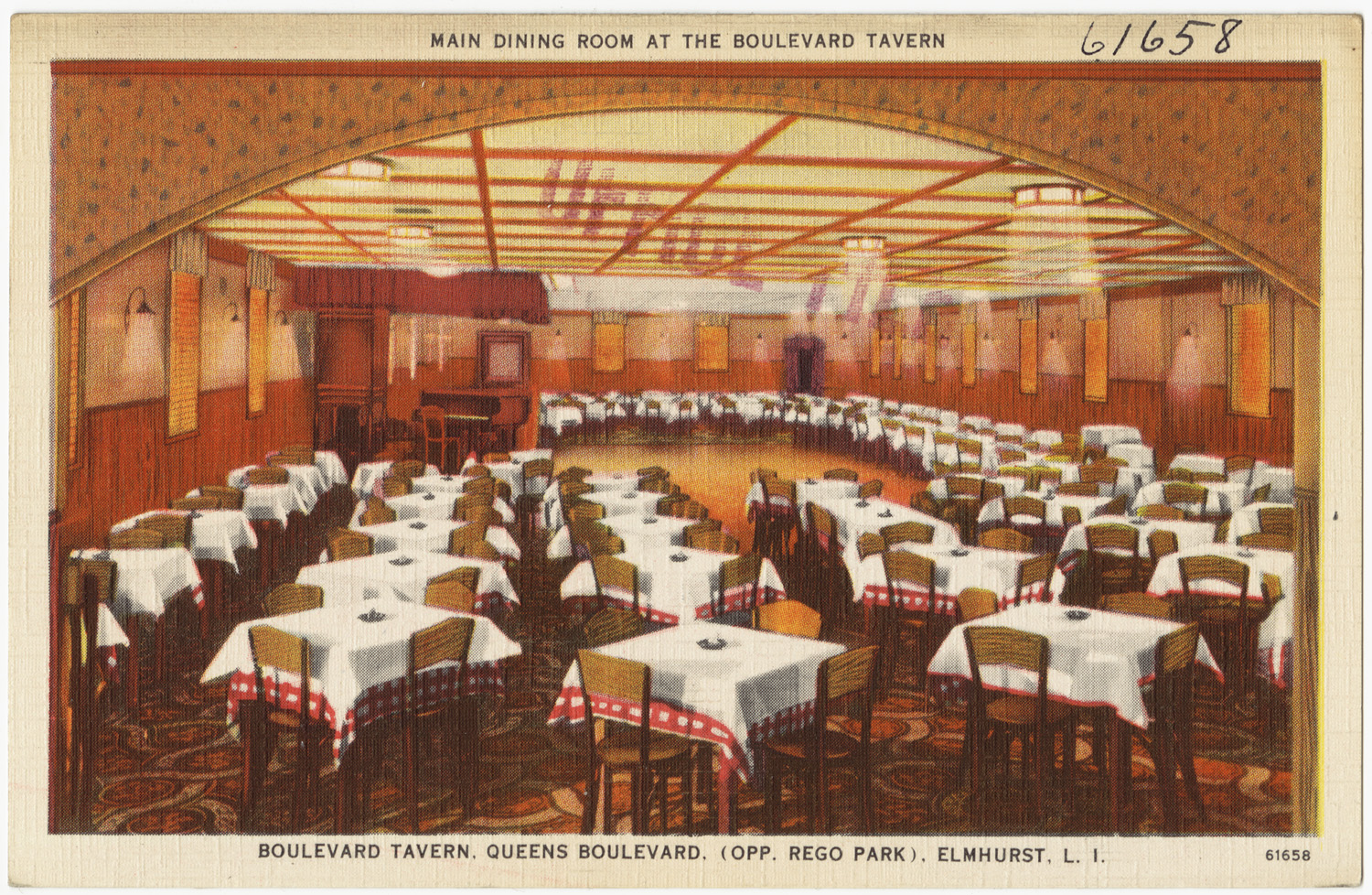
Near the Lost Battalion Hall stands a mysterious brick structure on Queens Boulevard, its canopy bearing the AT&T logo.
For much of the 20th century, this was the site of the Boulevard Tavern. Opened in 1929, it was, for many years, the only eatery in the area and became a popular venue for locals and community leaders.
It notably hosted politicians like John F. Kennedy and Robert F. Kennedy during the 1960s.
The tavern was sold and demolished in 1973. In its place, a large brick structure was built to house the AT&T Communications Center.
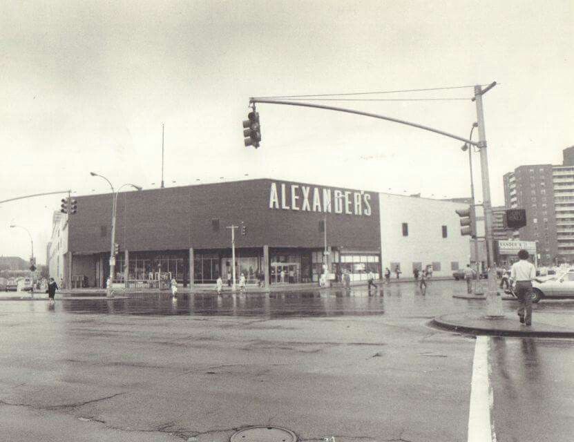
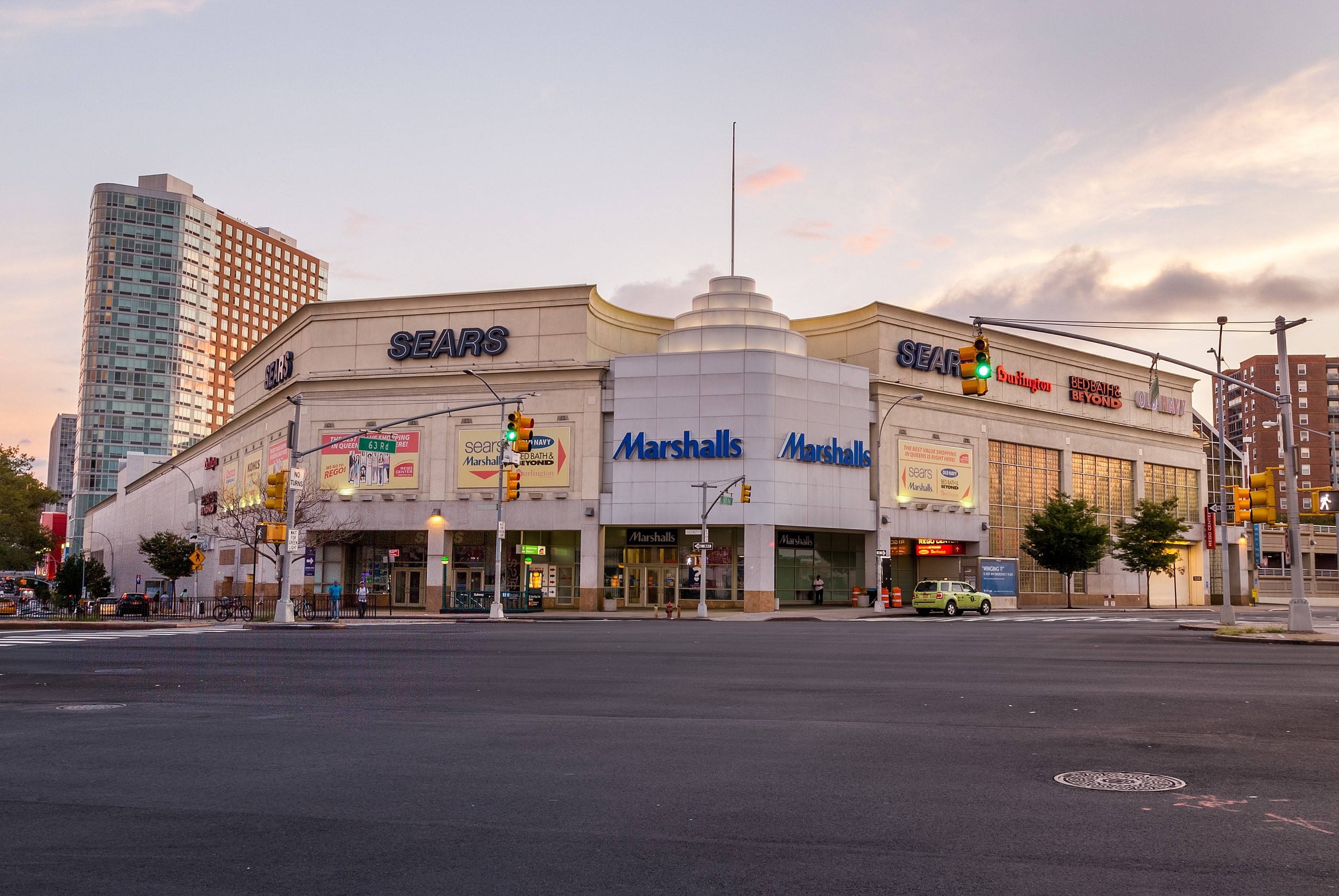
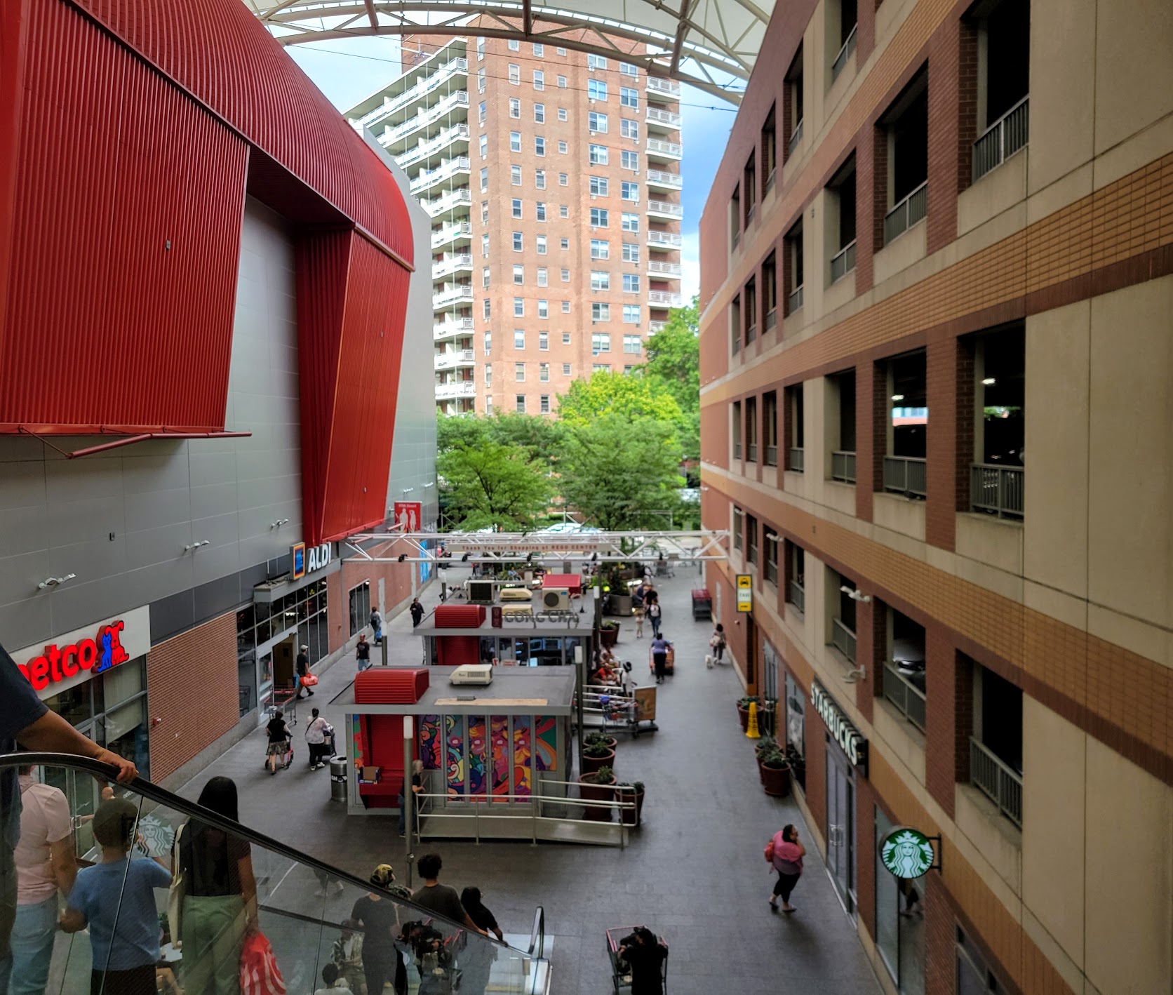
Rego Center spans two phases and sits on a property with a long retail history.
Phase 1 occupies the former site of Alexander’s, a department store that opened here on Valentine’s Day, 1959.
With three floors and 250,000 square feet, it was famous for discount bargains and once claimed more sales per square foot than any other store in the country.
After Alexander’s closed in 1993, the property was redeveloped as Rego Center, hosting Sears, Marshalls, and for some time an IKEA. In recent years, these stores have closed or shifted to the newer phase.
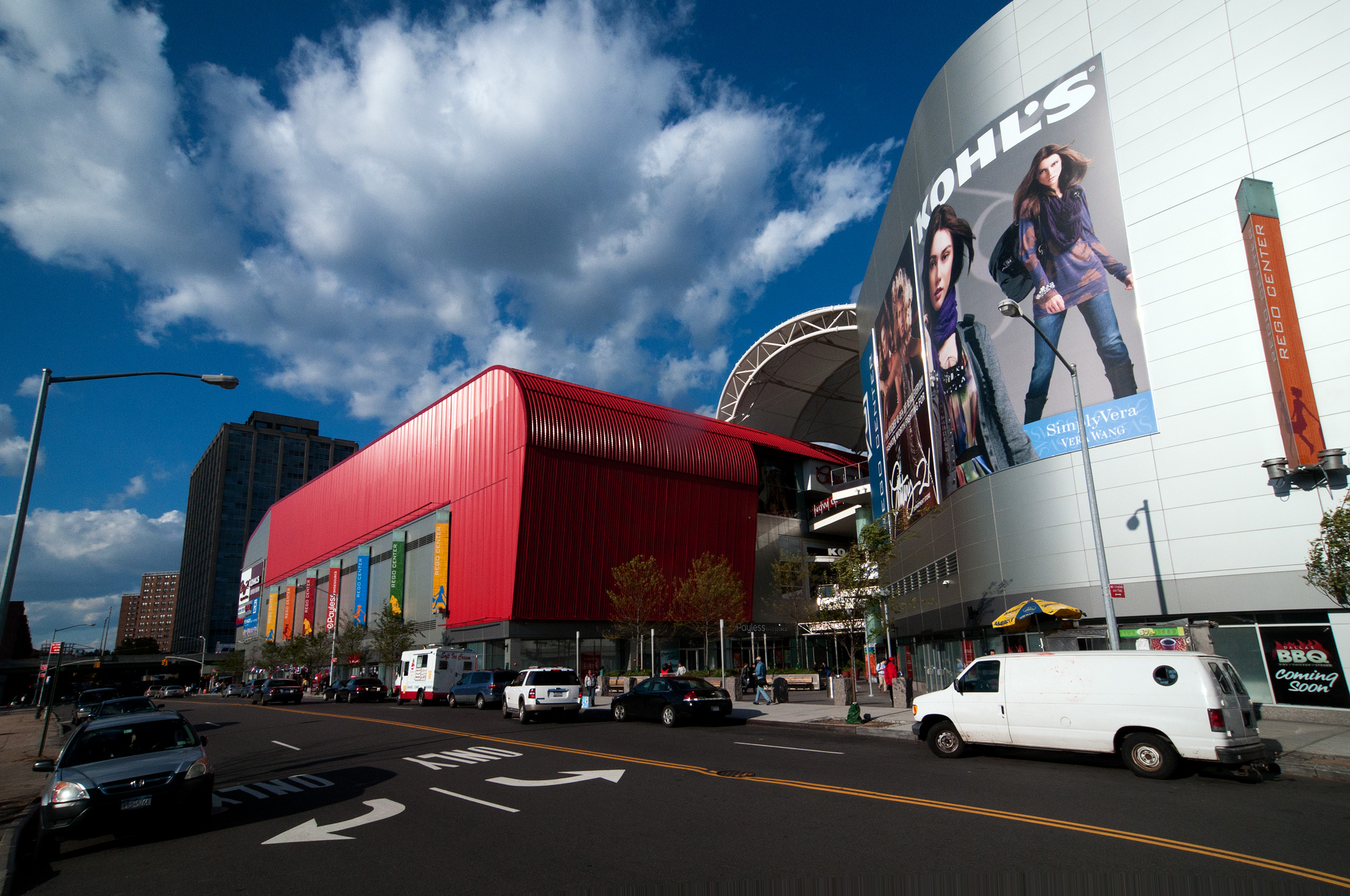
Phase 2, completed in 2010, extends toward Horace Harding Expressway. It is an open-air mall, with escalators climbing between levels under a canopy. Groceries and restaurants can be found on the ground floor, with retail and department stores above and below.
In the past, my visits here were usually to Costco with my father, descending to the vast underground warehouse with its endless aisles.
These days, I come more often with my partner for frozen yogurt from Red Mango, bubble tea from Gong Cha, or a few slices at Champion Pizza.
We enjoy the outdoor seating under the canopy. There are metal tables and chairs to sit down and eat, or the benches where people settle in longer, turning this mall into something like a public square.
Photo by Lev Izraelit. Licensed under CC BY-SA 4.0
Photo by Lev Izraelit. Licensed under CC BY-SA 4.0
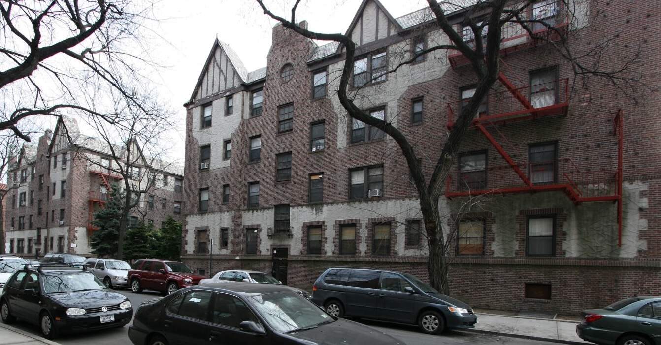
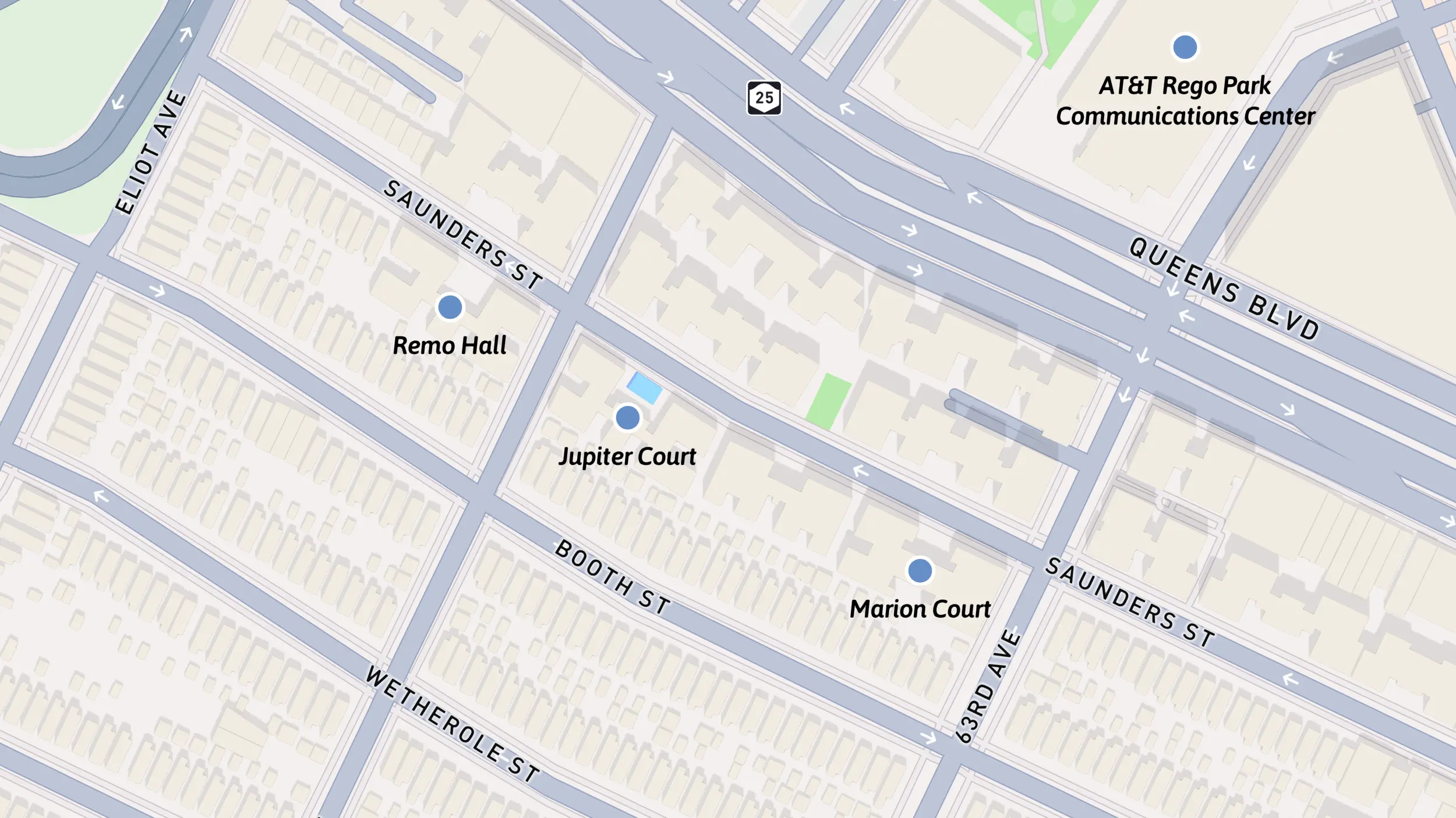
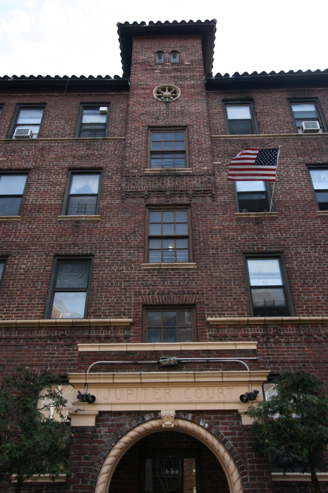
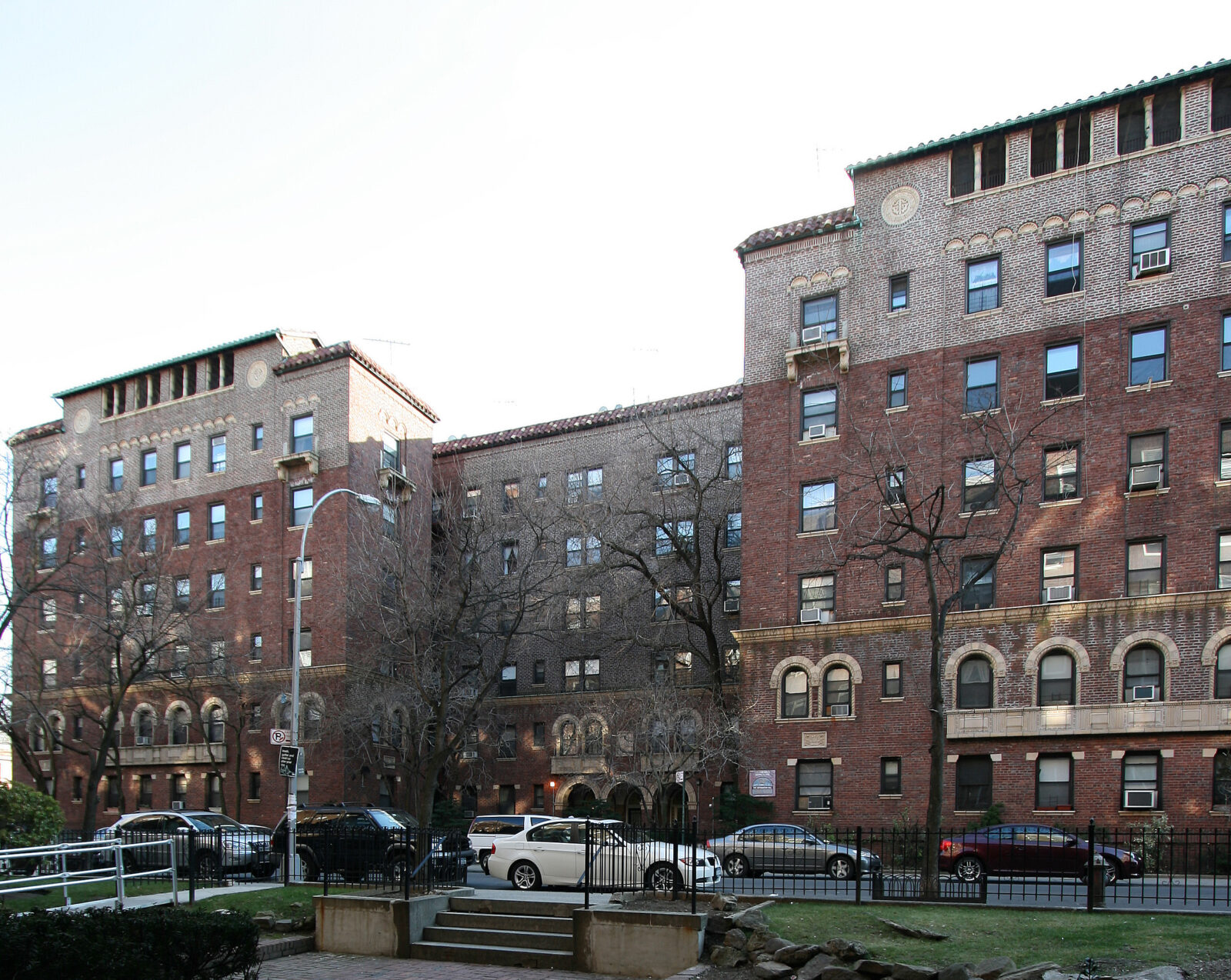
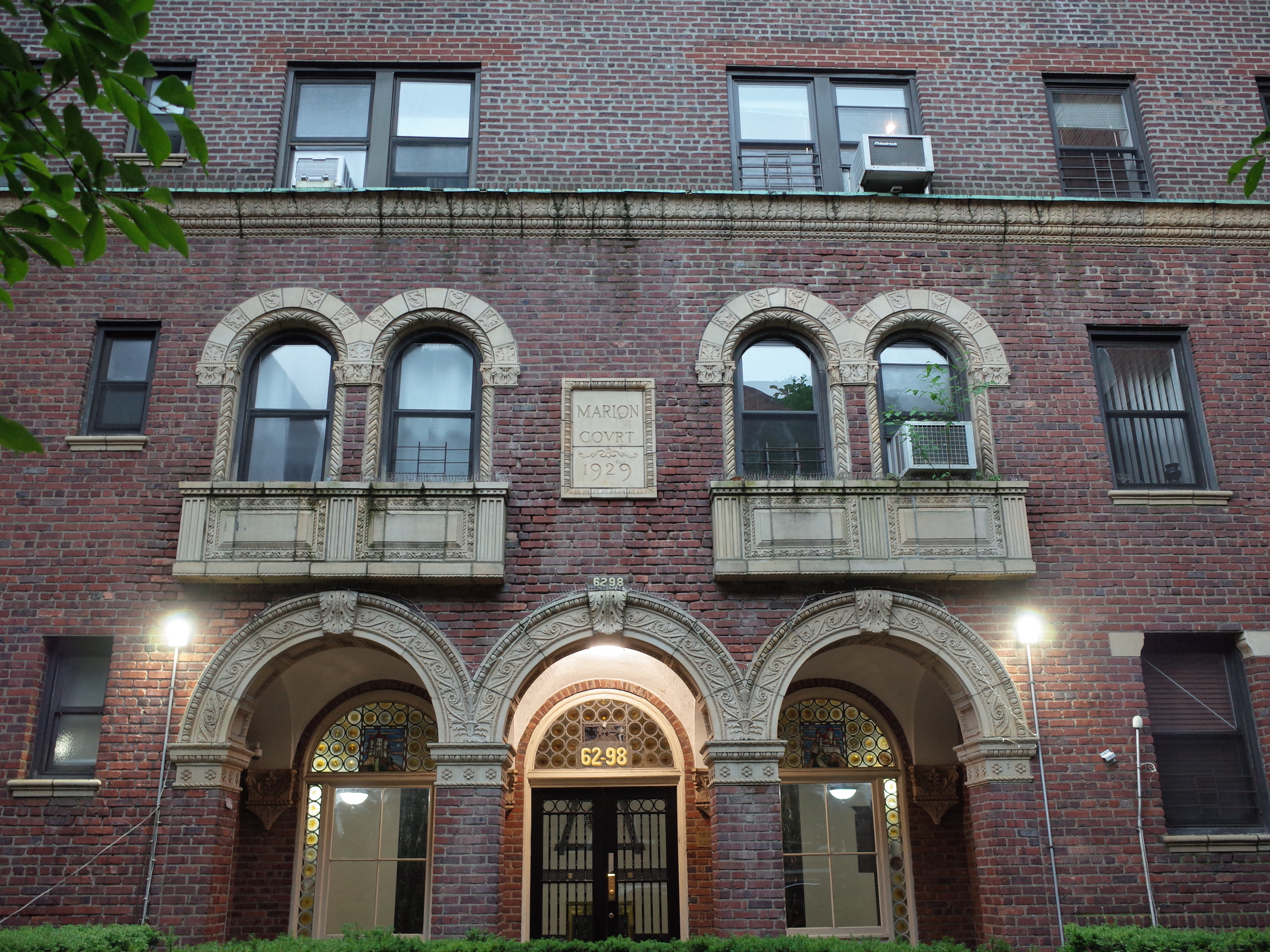
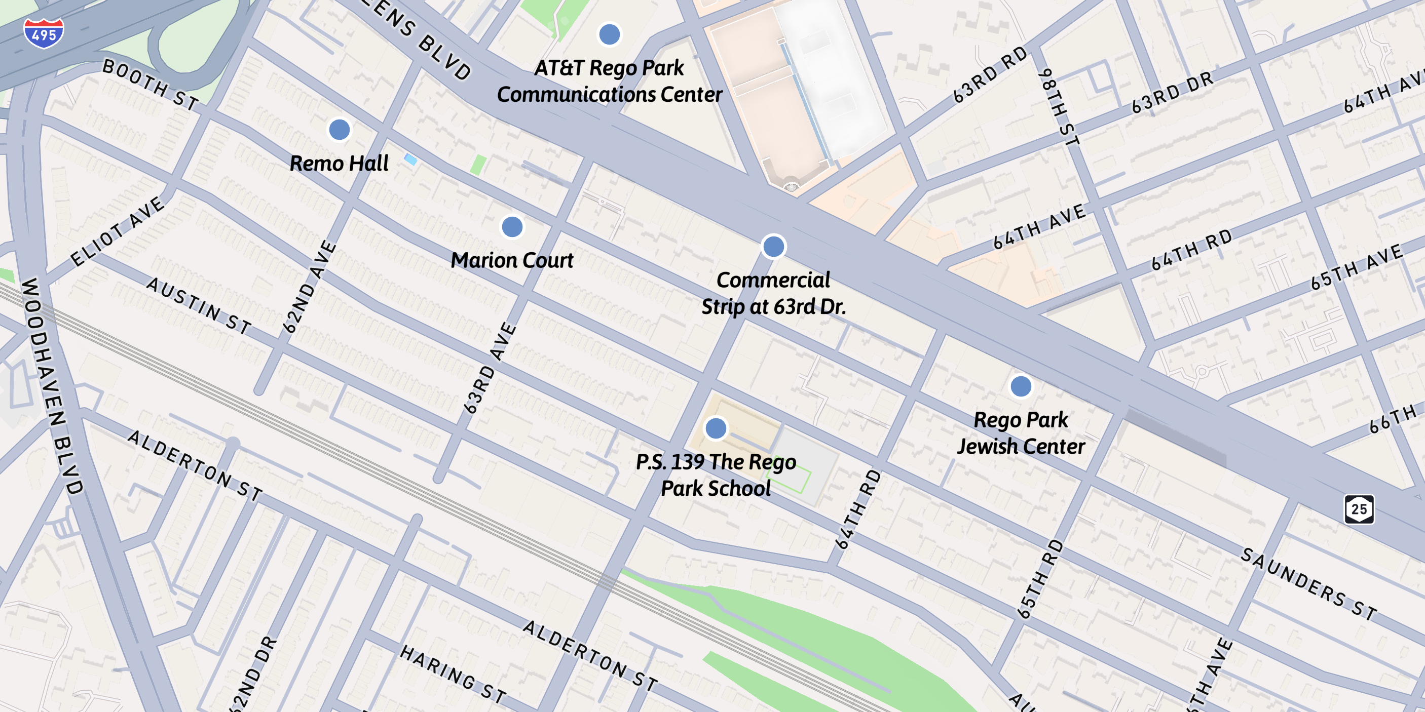
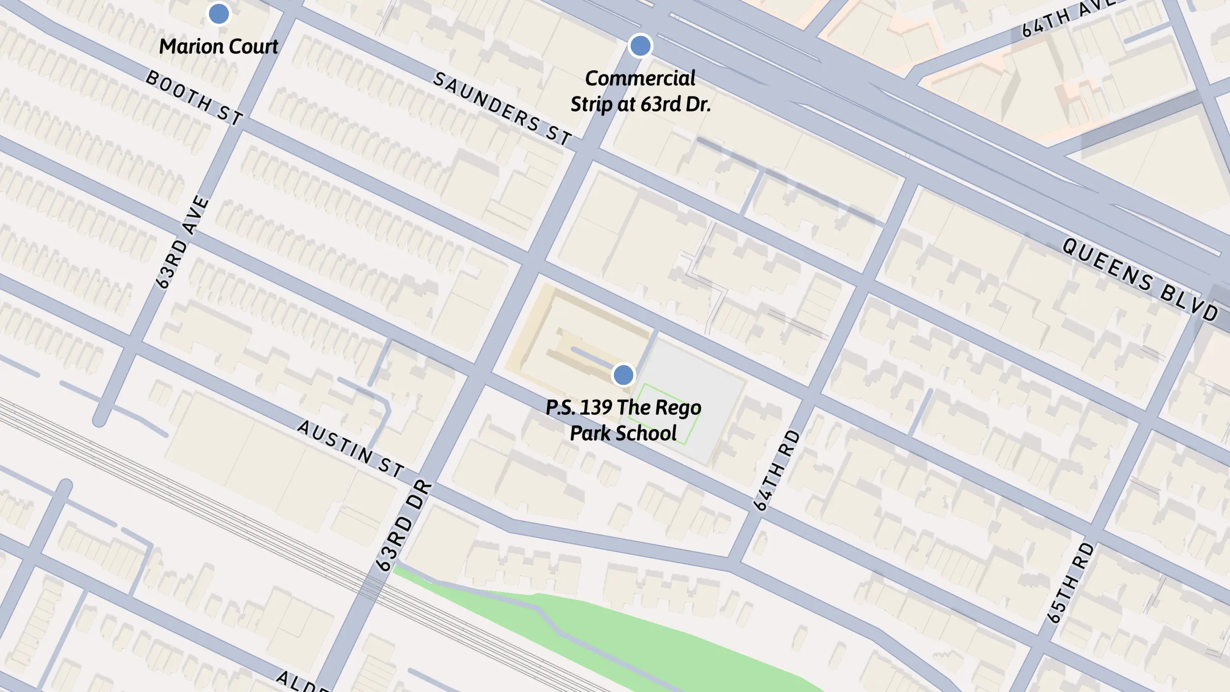
Remo Hall, Jupiter Court & Marion Court
Built 1927-29
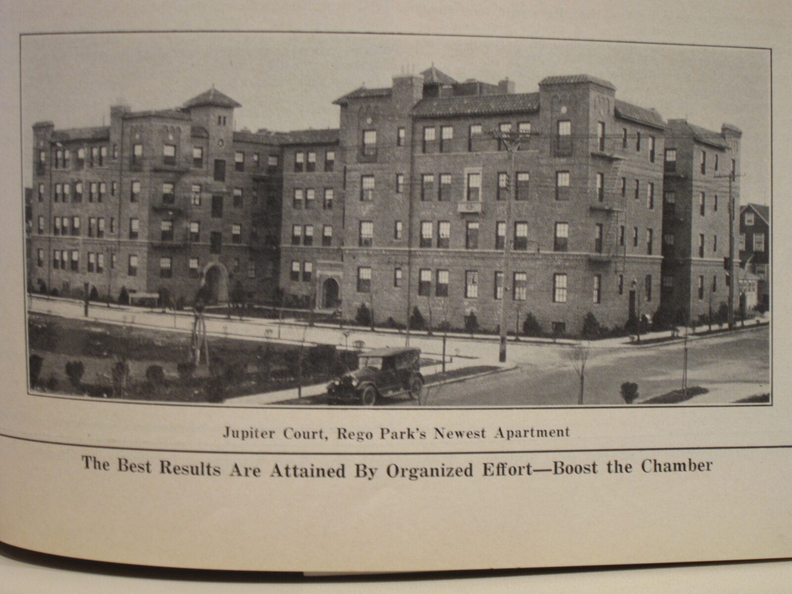
Remo Hall, Jupiter Court and Marion Court are located on Saunders Street, to the south of Queens Boulevard. These are some of the earliest buildings constructed by the Rego Construction company.
Remo Hall and Jupiter Court were built in 1927.
Each features terra-cotta details and ornamentation, with recessed façades and courtyards to maximize fresh air and light.
Marion Court was built two years later.
It includes animal-themed carvings, leaded-glass depictions of castles, and a roof garden.
The success of Remo Hall, Jupiter Court and Marion Court helped make apartment buildings a preferred type of development in Rego Park.
Photo by Lev Izraelit. Licensed under CC BY-SA 4.0
Photo by Historic Districts Council
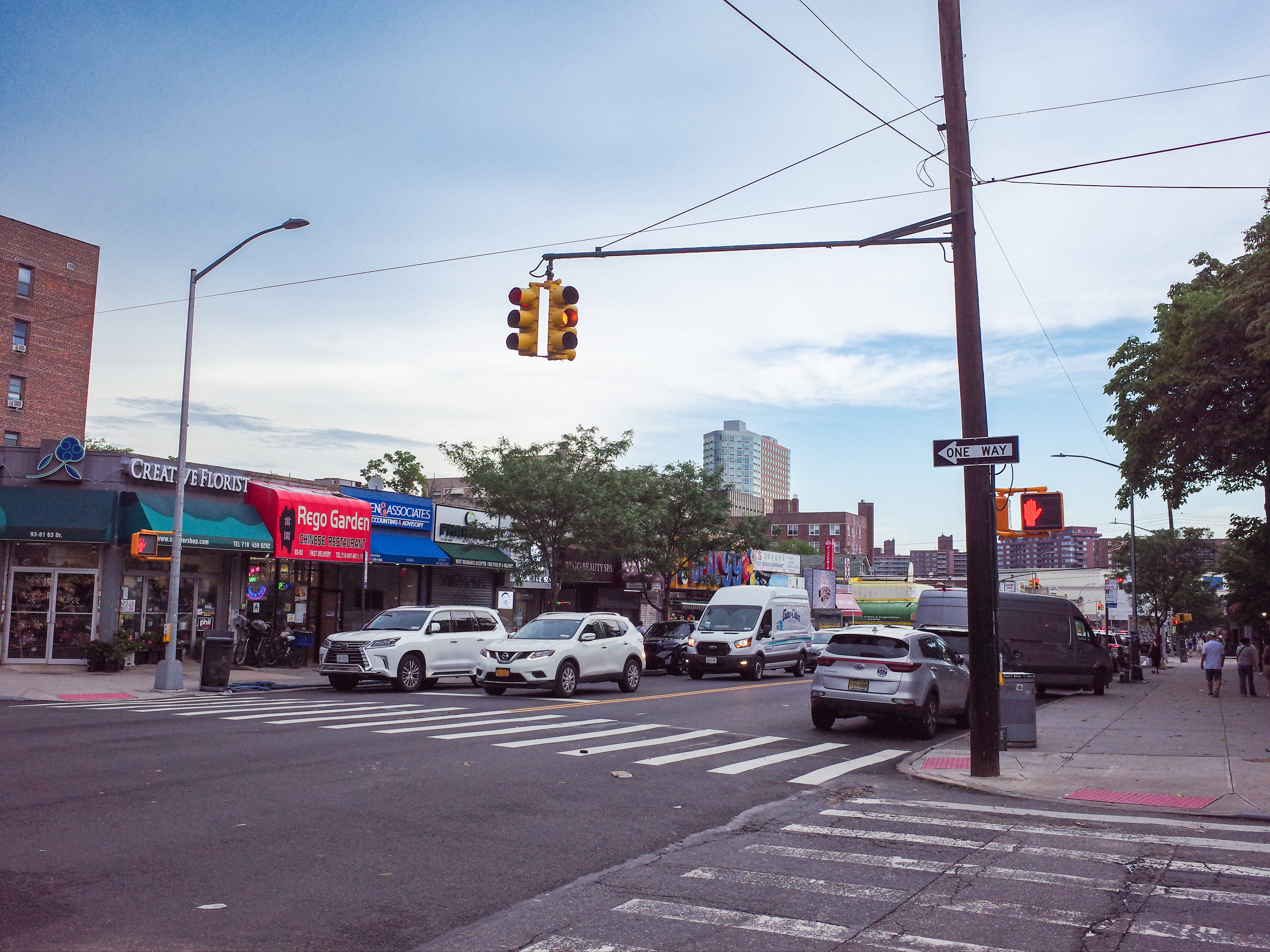
Commercial Strip at 63rd Dr.
ca. 1940
The commercial strip at 63rd Drive extends from Queens Boulevard to Alderton Street.
When Rego Park was originally developed in 1923, 63rd Drive was planned to be a residential street.
In 1947, Bronx native Robert E. Hill seized on an opportunity to purchase houses along 63rd Drive to build commercial properties. Some of the original Art Deco limestones can still be seen above the storefronts.
In the 1990s, many Jewish immigrants from the former Soviet Union, particularly from Central Asian countries such as Georgia, Uzbekistan and Tajikistan, moved into the neighborhood.
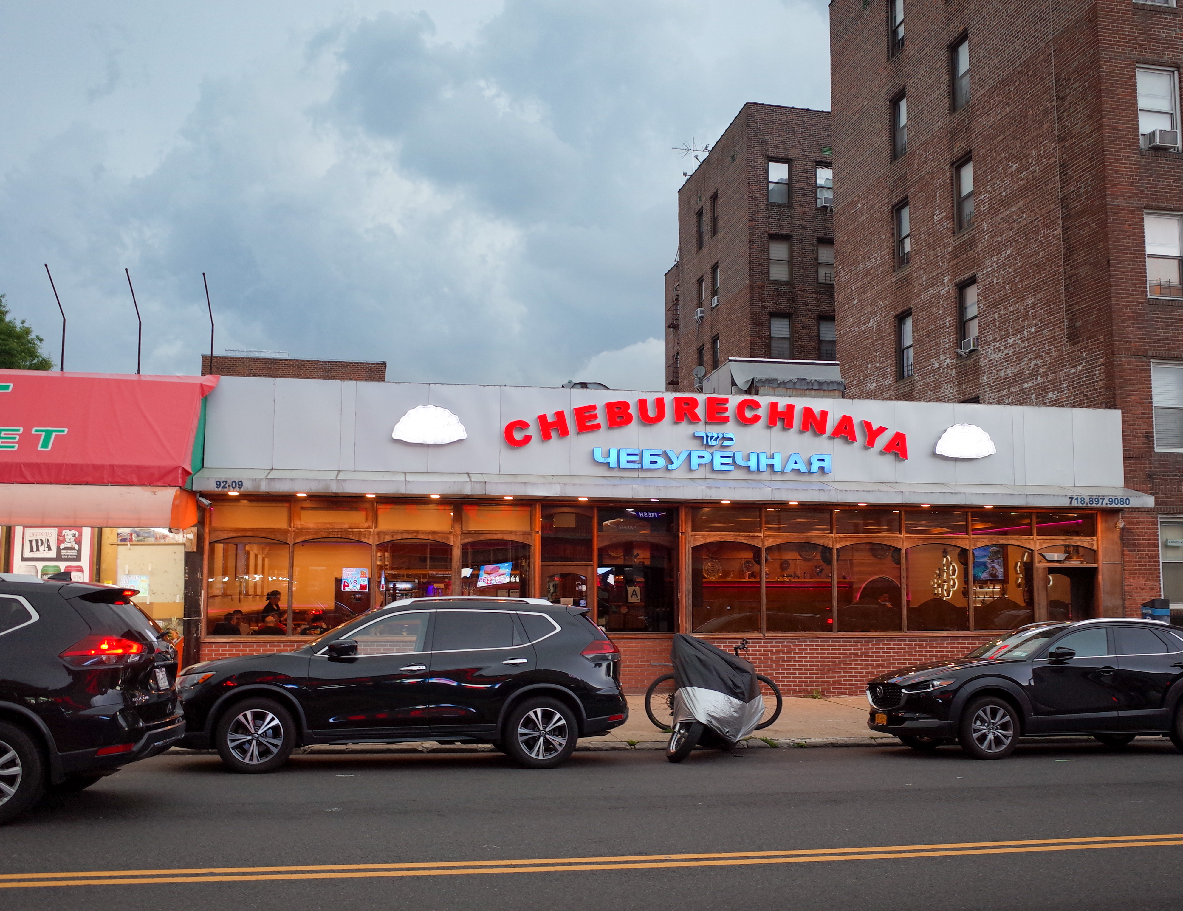
Local restaurants serving this community include Marani, Chaikhana Sem Sorok, and Cheburechnaya, known for chebureki - half-moon, deep-fried turnovers filled with a savory blend of ingredients - and a variety of kebabs.
These days, the strip has grown to serve a wide range of cuisines for its diverse population.
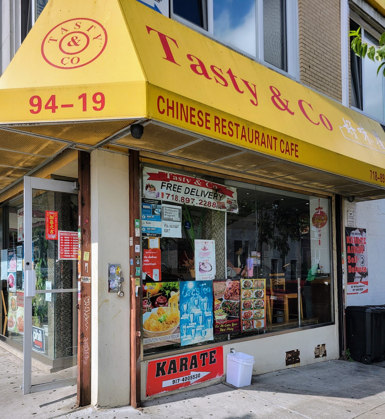
I sometimes take out a Pad See Ew at UThai for lunch; Tasty & Co tempts with Hong Kong–style baked goods stacked behind glass.
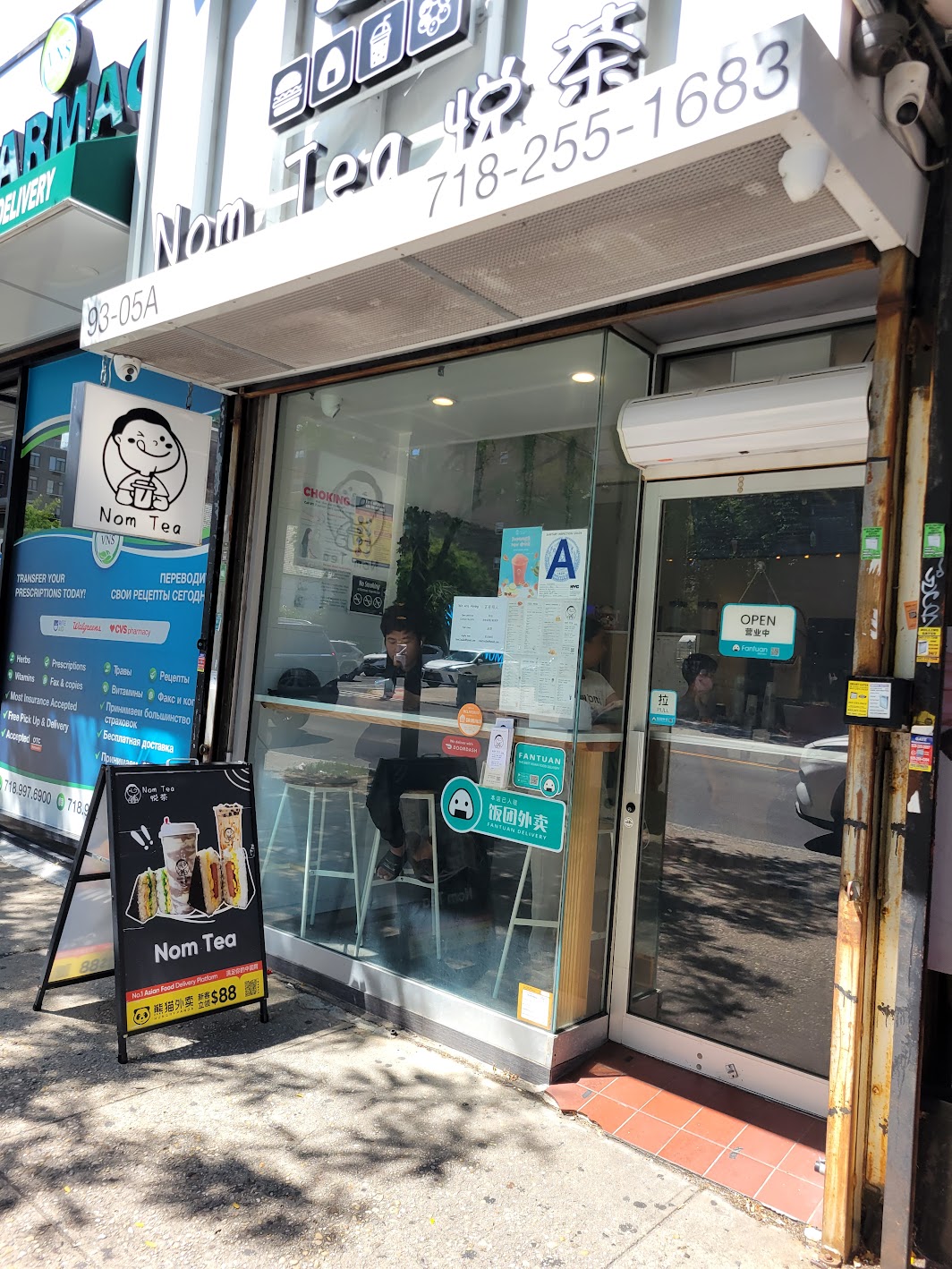
At Nom Tea, I’ll sometimes pick up a milk tea with onigiri for a light dinner.
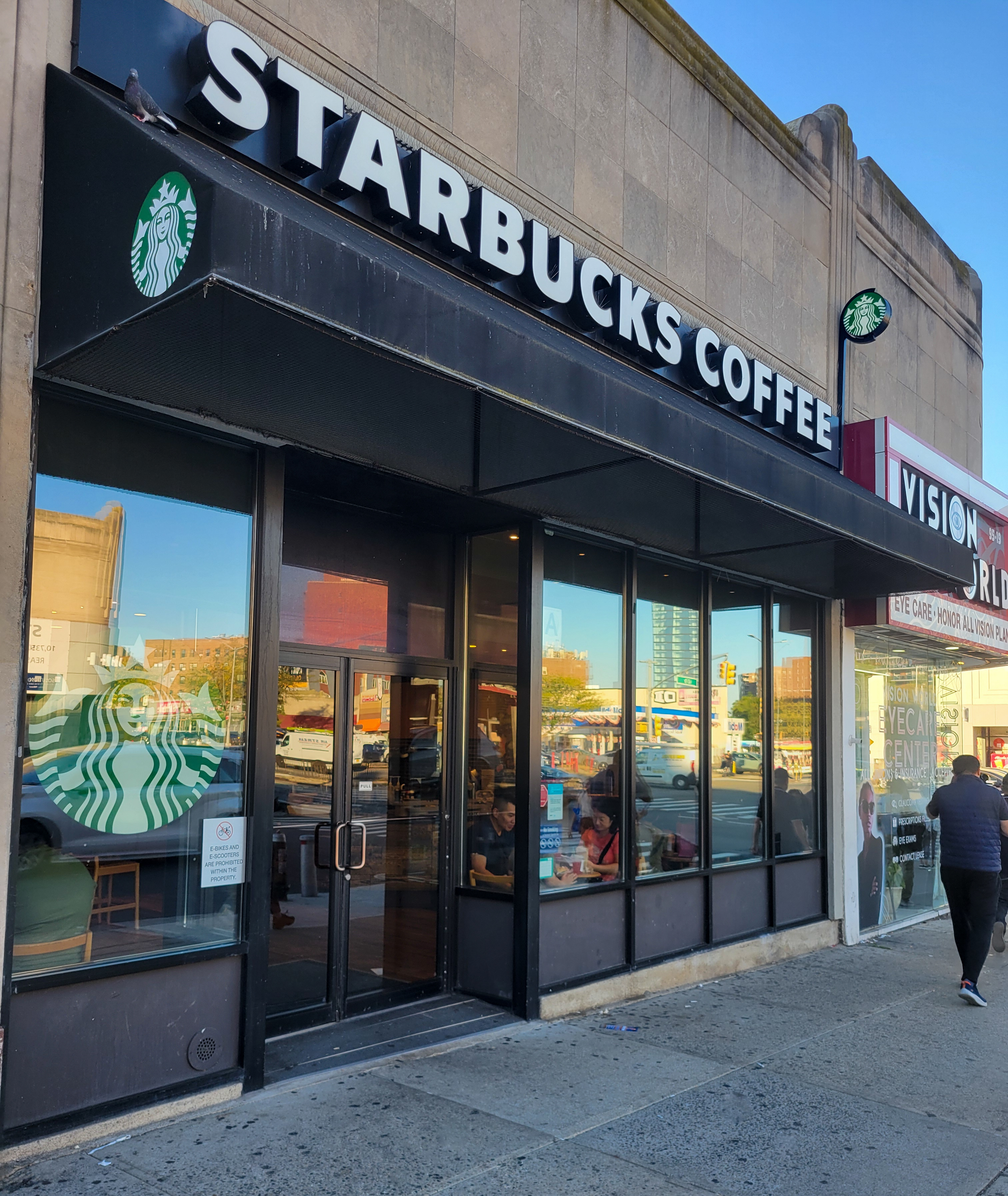
And a Starbucks anchors the block in its own way: parents and kids chatting, teenagers after school, others tapping away on laptops or simply resting after errands.
The strip remains one of the neighborhood’s commercial corridors and an important part of community life.
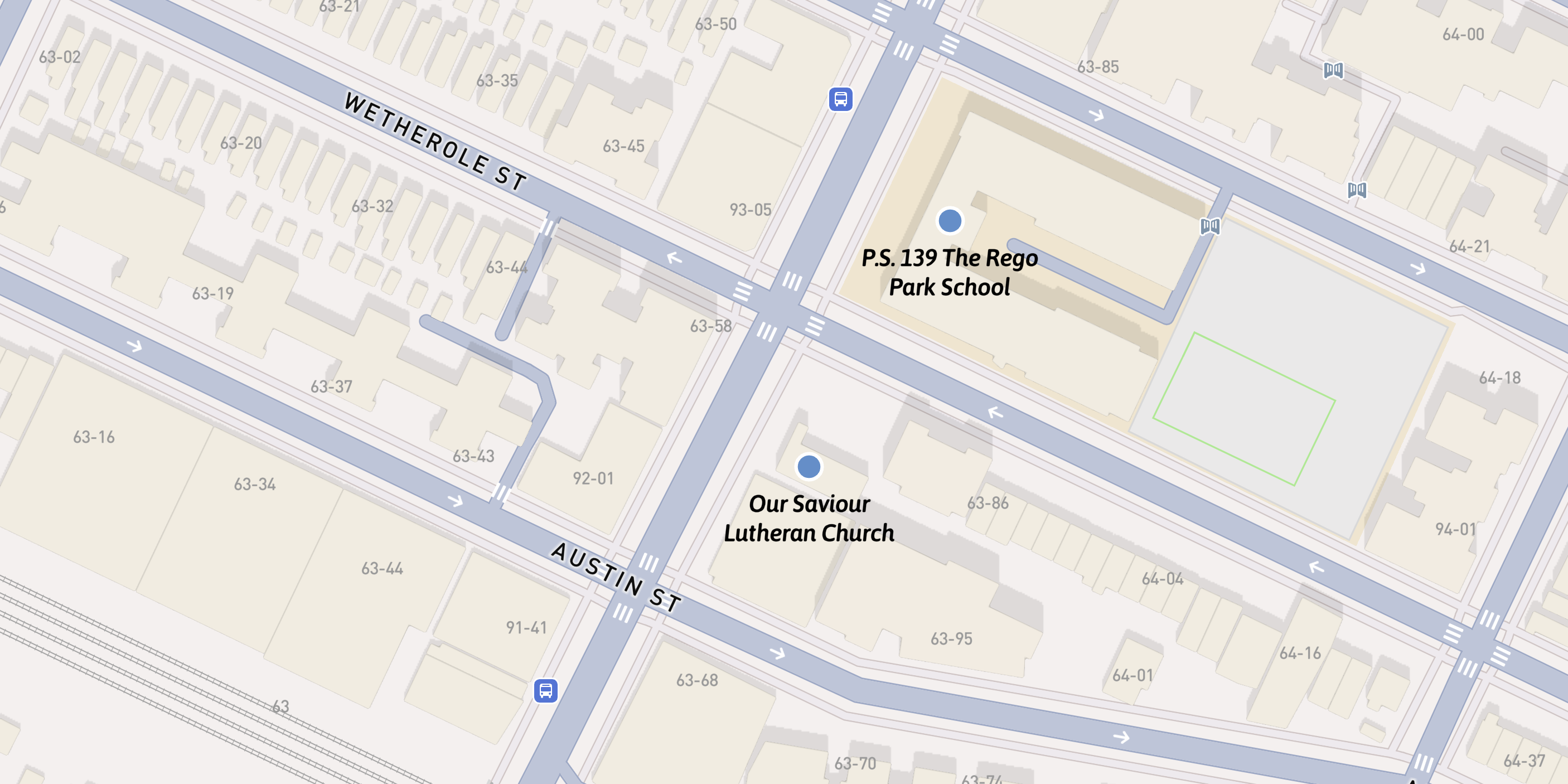
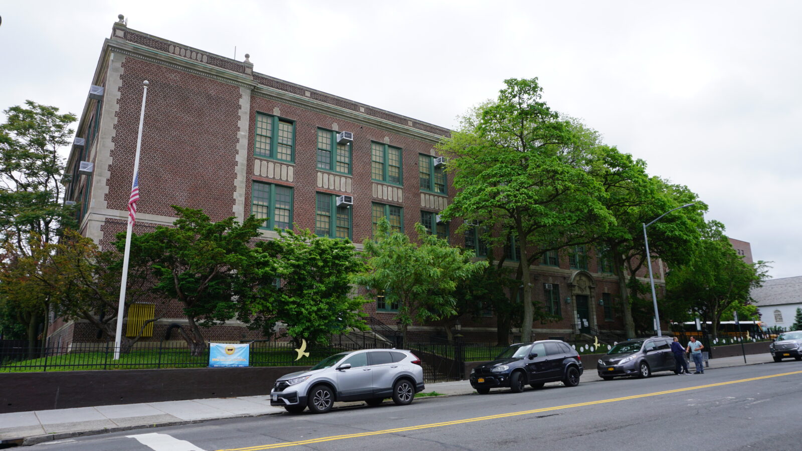
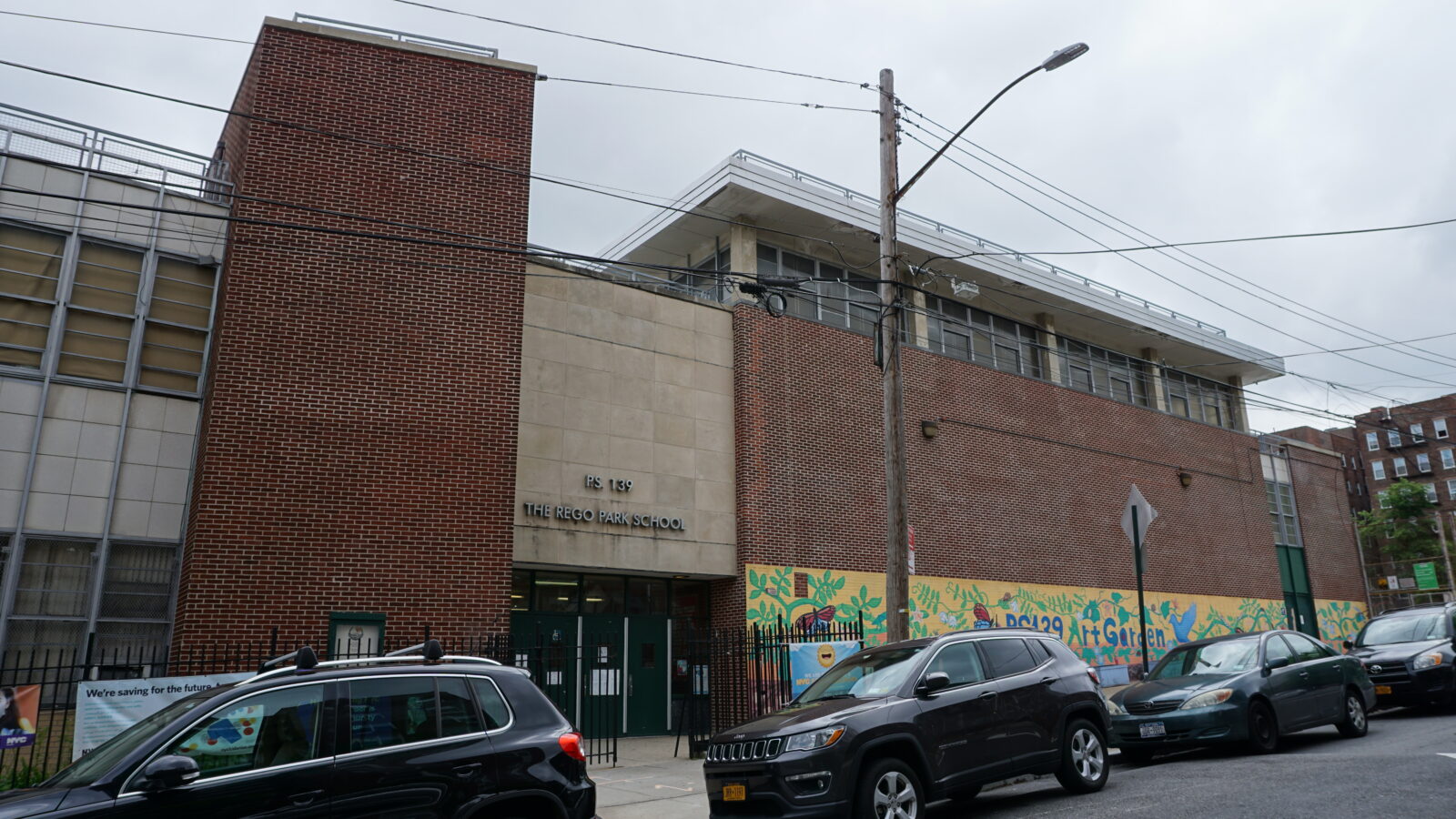
Alongside the stores on 63rd Drive stands the three-story brick building of the Rego Park School at 93-06 63rd Dr.
The population growth of the early 1920s prompted the community to lobby for a public school.
In 1928, the Board of Education constructed this three-story brick structure under its building program, featuring elements typical of educational facilities of the time.
The school had an initial capacity for 895 students. The layout anticipated future growth, allocating space for two additional wings, completed in 1960, with a modular addition in 1998.
By afternoon, the pace softens. Elderly neighbors make their steady way to the supermarkets or rest on benches along 63rd Drive.
Later, parents gather again outside P.S. 139, and the air fills with a mix of languages and overlapping voices.
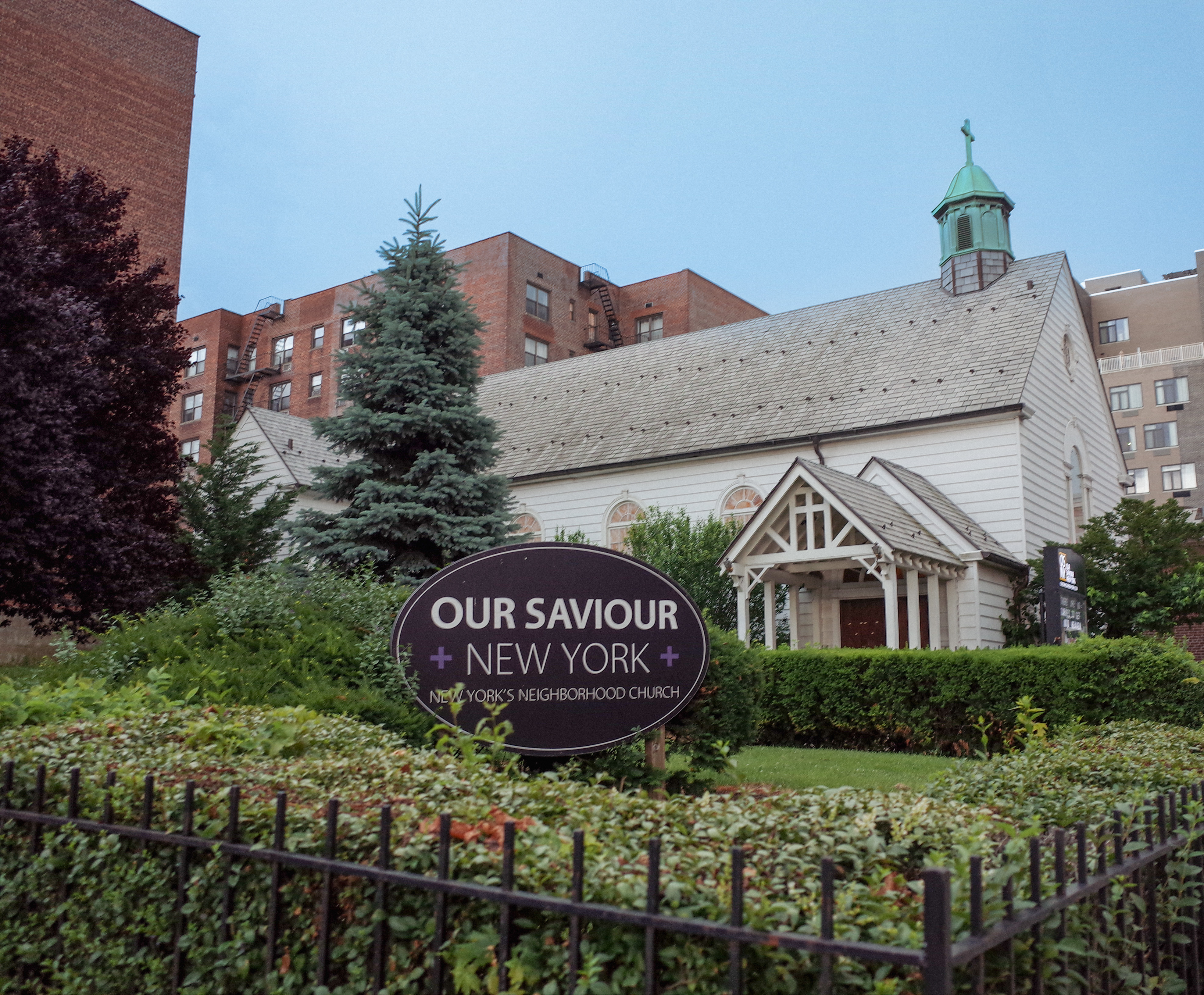
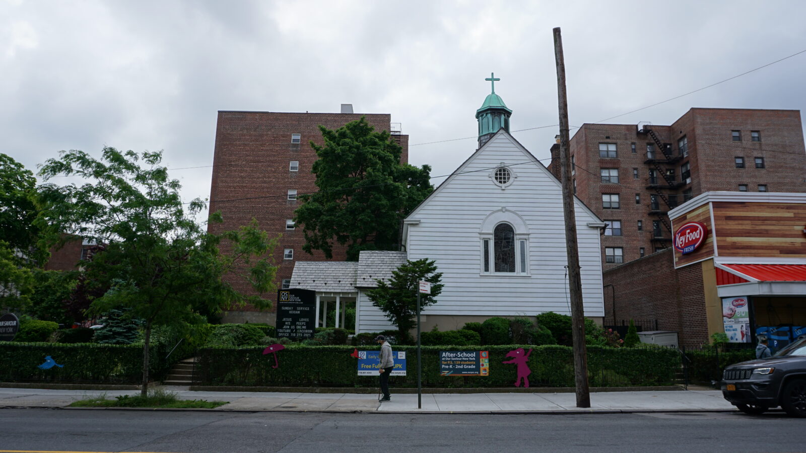
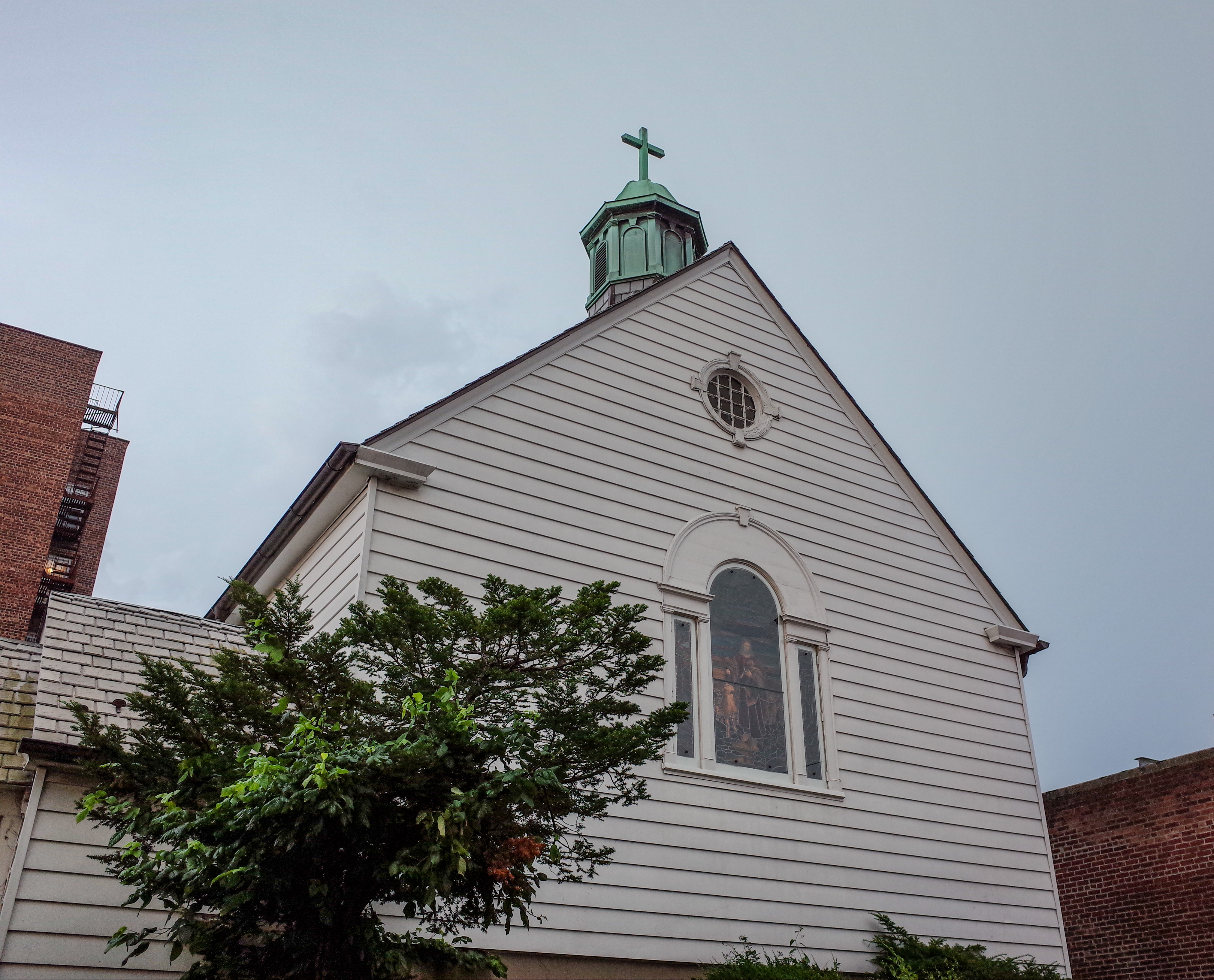
Across the street from P.S. 139 is the colonial-style Lutheran Church of Our Savior.
In 1930, after continued growth, the Neighborhood Lutheran Church of Rego Park congregation began a campaign to build this colonial-style structure with a Sunday School room in its basement.
Construction began in the fall of 1931 and was completed the following year.
Today, the church maintains most of its original features, including a stained-glass window, a cupola, arched windows with a pitched roof, and a large garden.
By the late 1930s, the south side of Queens Boulevard was lined with brick structures that combined classical and contemporary features.
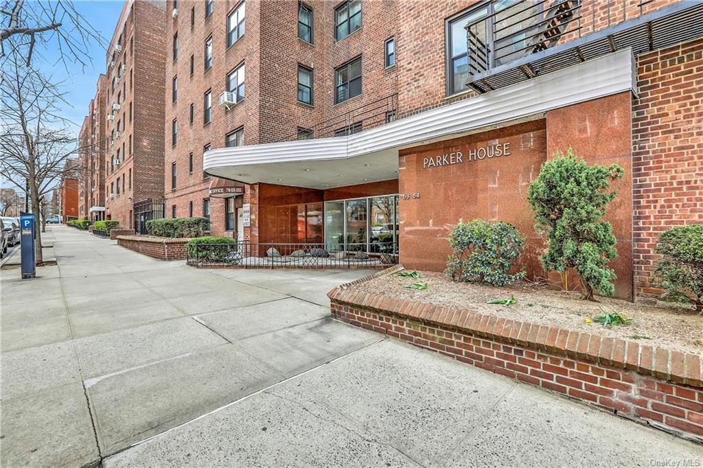
Parker House (63-84 Saunders St), built in the 1950s, maintains the overall characteristics of earlier structures, but also includes mid-century elements that would become distinctive in apartment buildings in the area.
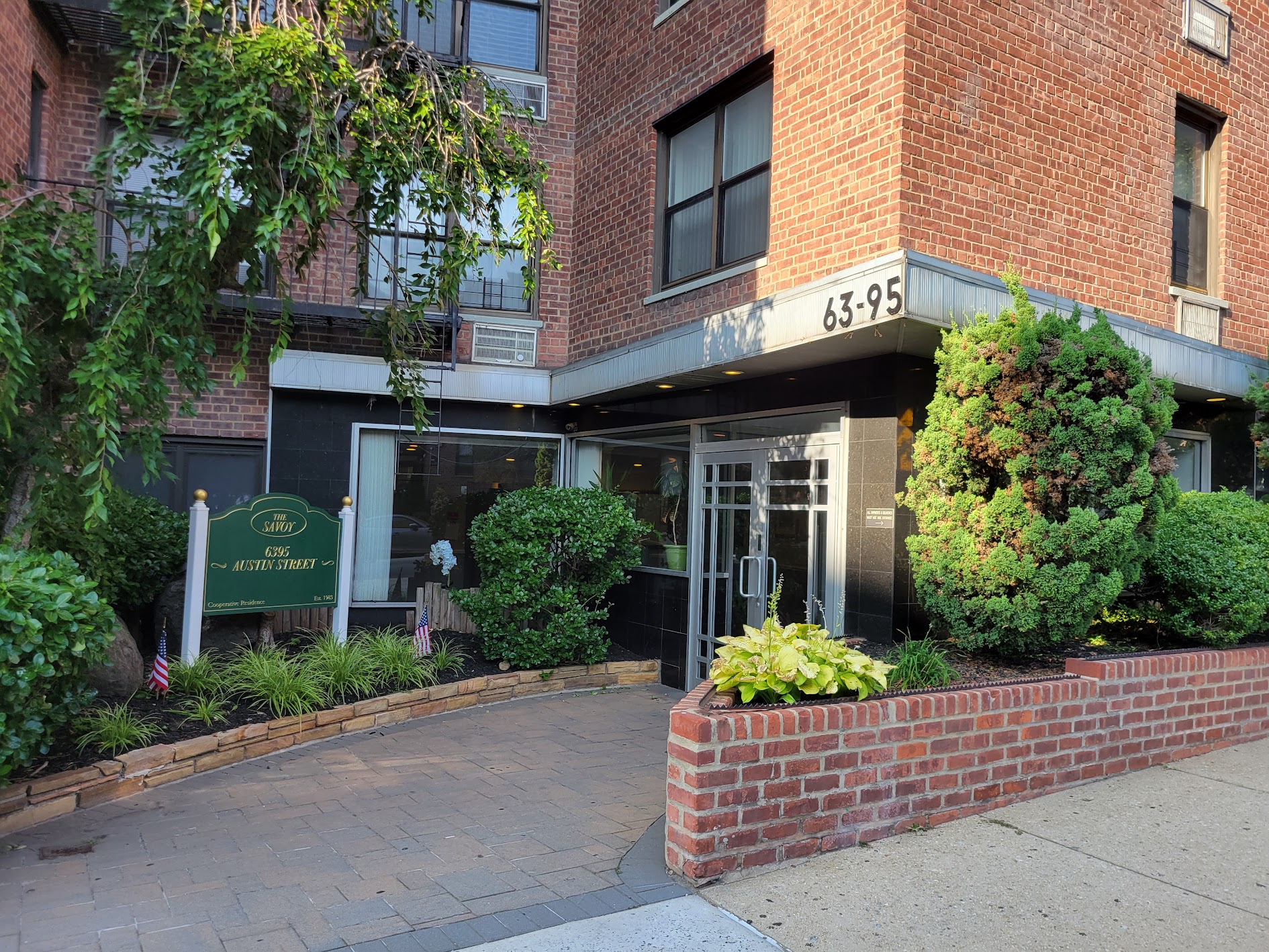
The Savoy (63-95 Austin Street), completed in 1960, is a six-story building featuring a small front garden and a functional design that reflects its mid-century origins.
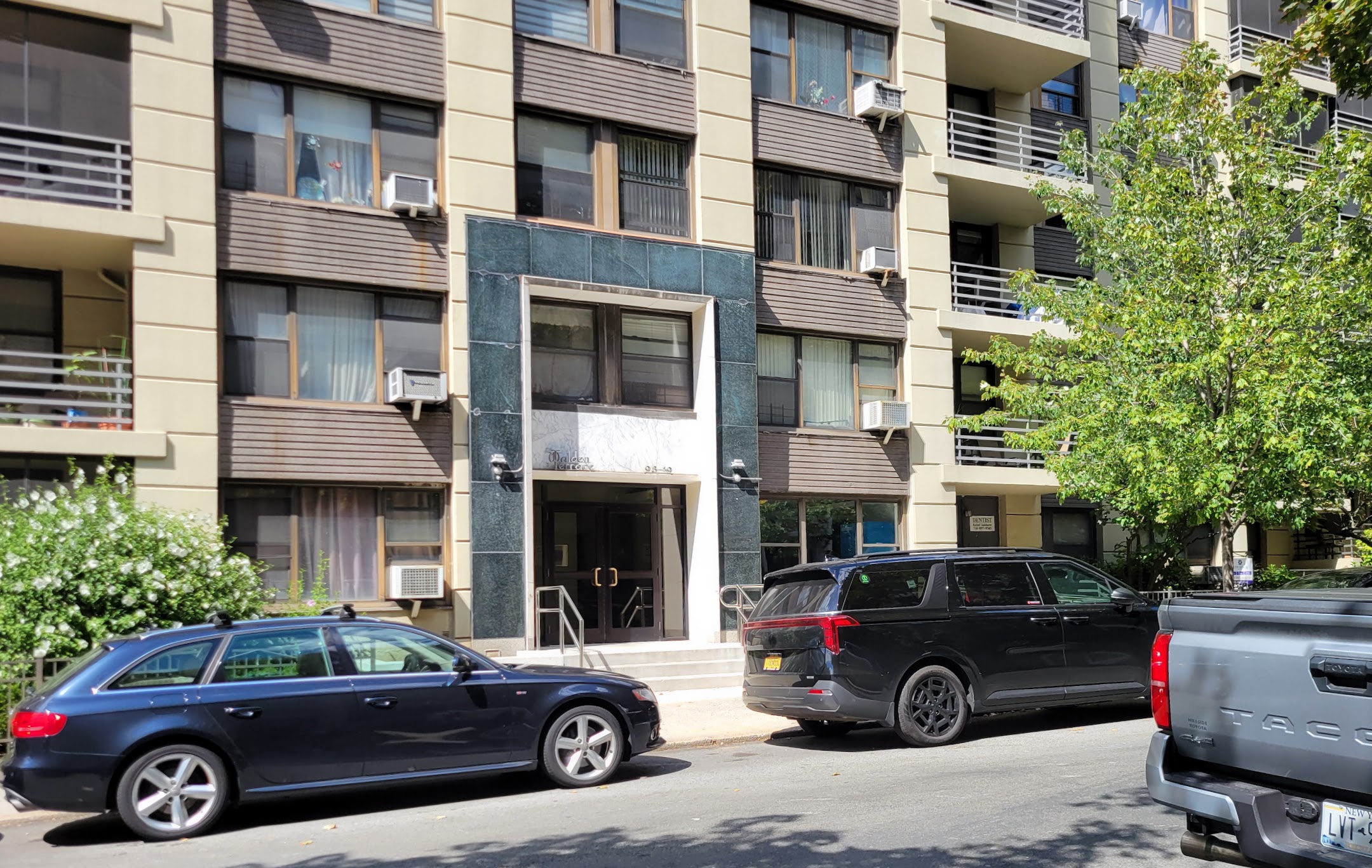
Walden Terrace (1948–49) is a group of twelve eight-story apartment buildings north of Queens Boulevard.
With exposed concrete walls and courtyards, the Walden Terrace complex stands out among the surrounding red-brick structures while maintaining continuity with the neighborhood’s built landscape.
Photo by Lev Izraelit. Licensed under CC BY-SA 4.0
Photo by Historic Districts Council
Photo by Lev Izraelit. Licensed under CC BY-SA 4.0
Photo by Lev Izraelit. Licensed under CC BY-SA 4.0
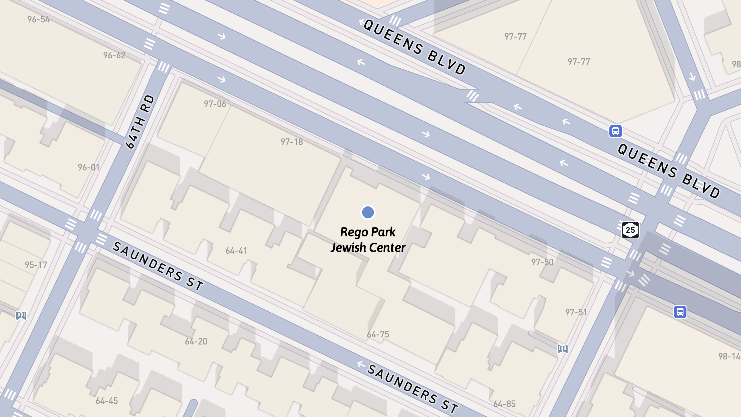
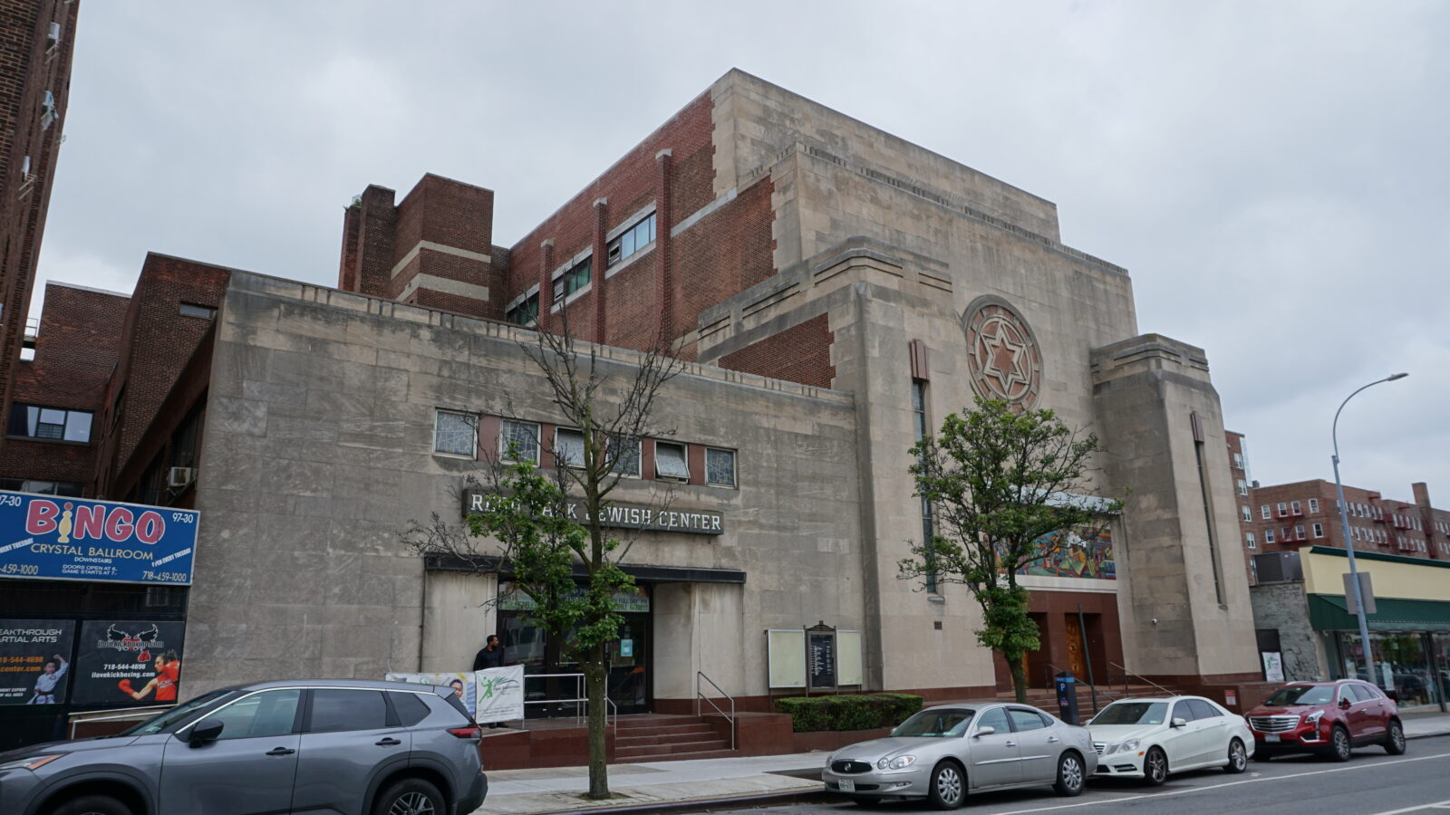
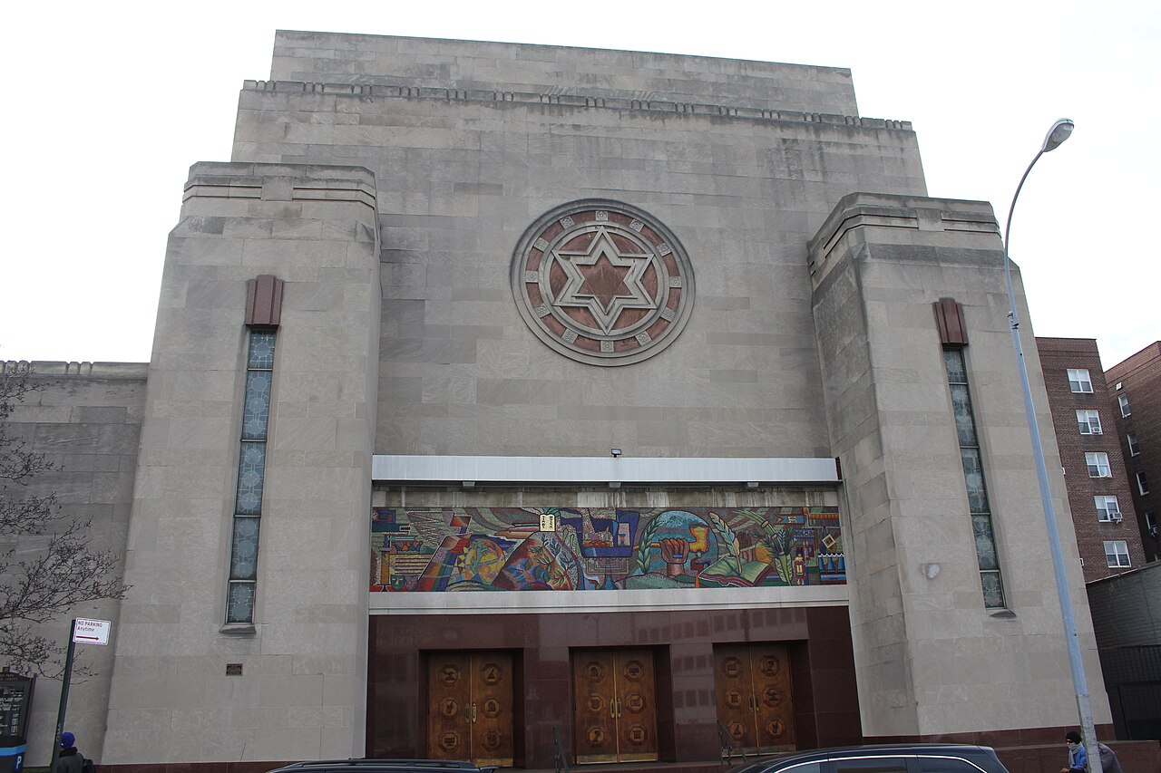
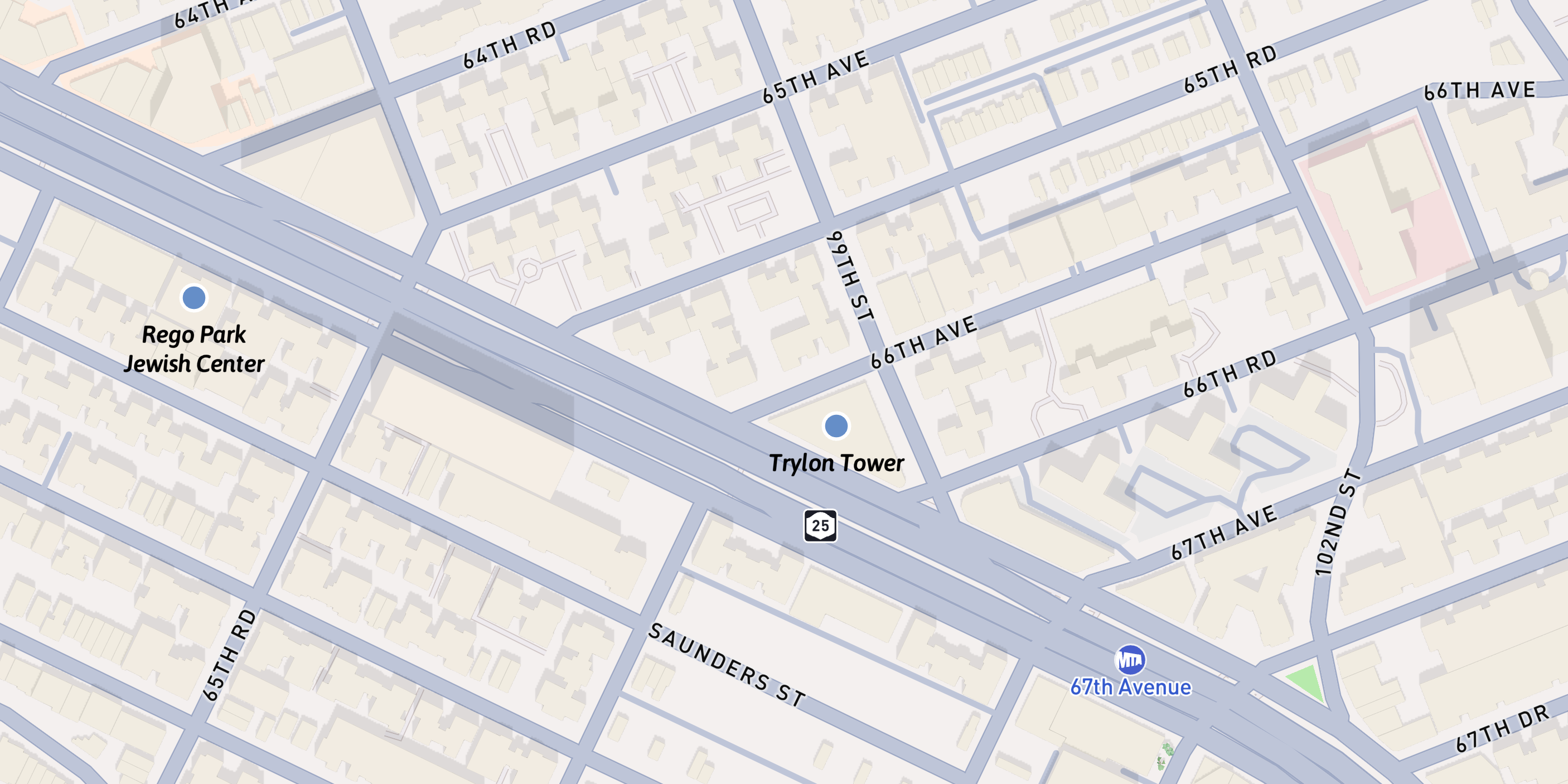
Rego Park Jewish Center
Built 1948
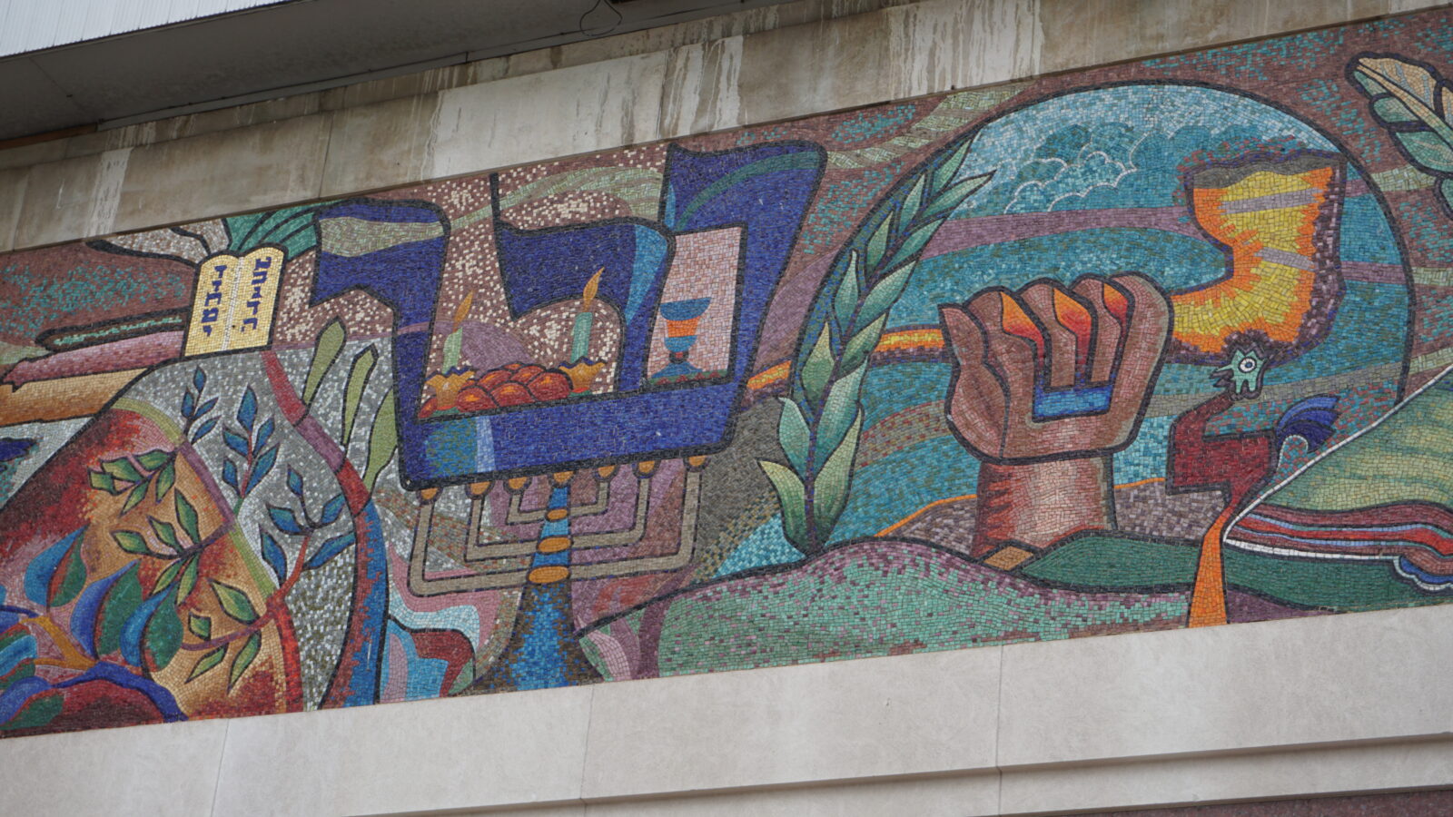
Eastward on Queens Boulevard stands the Rego Park Jewish Center, its façade accented by a large mosaic and, above it, the Star of David.
After World War II, the Jewish population of Rego Park, Kew Gardens, and Forest Hills grew significantly, increasing the need for synagogues to serve these communities.
The Rego Park Jewish congregation purchased a lot on Queens Boulevard in 1942 to build a “temple and recreation hall.” The groundbreaking ceremony in 1946 included remarks by Mayor O’Dwyer.
The design by architect Frank Grad was among the first modern synagogues in New York City.
The façade’s mosaic features ornamental letters of the Hebrew alphabet interlocking with Jewish symbols.
The center was listed on the National Register of Historic Places in 2009.
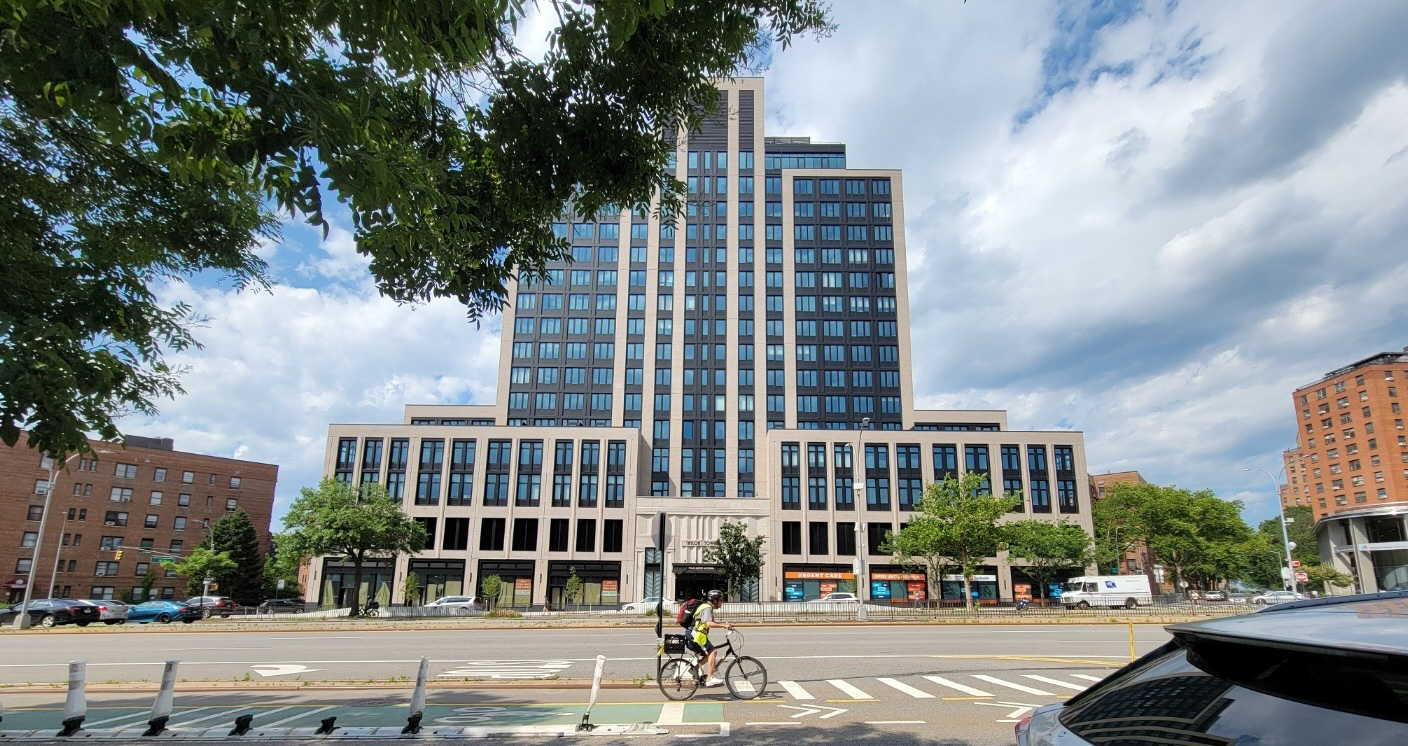
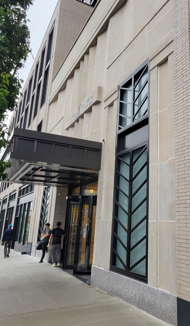
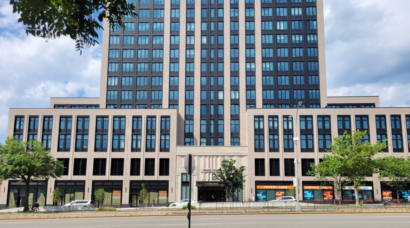
Farther east is Trylon Tower, a newly constructed 16-story rental development that takes inspiration from New York City’s Art Deco past.
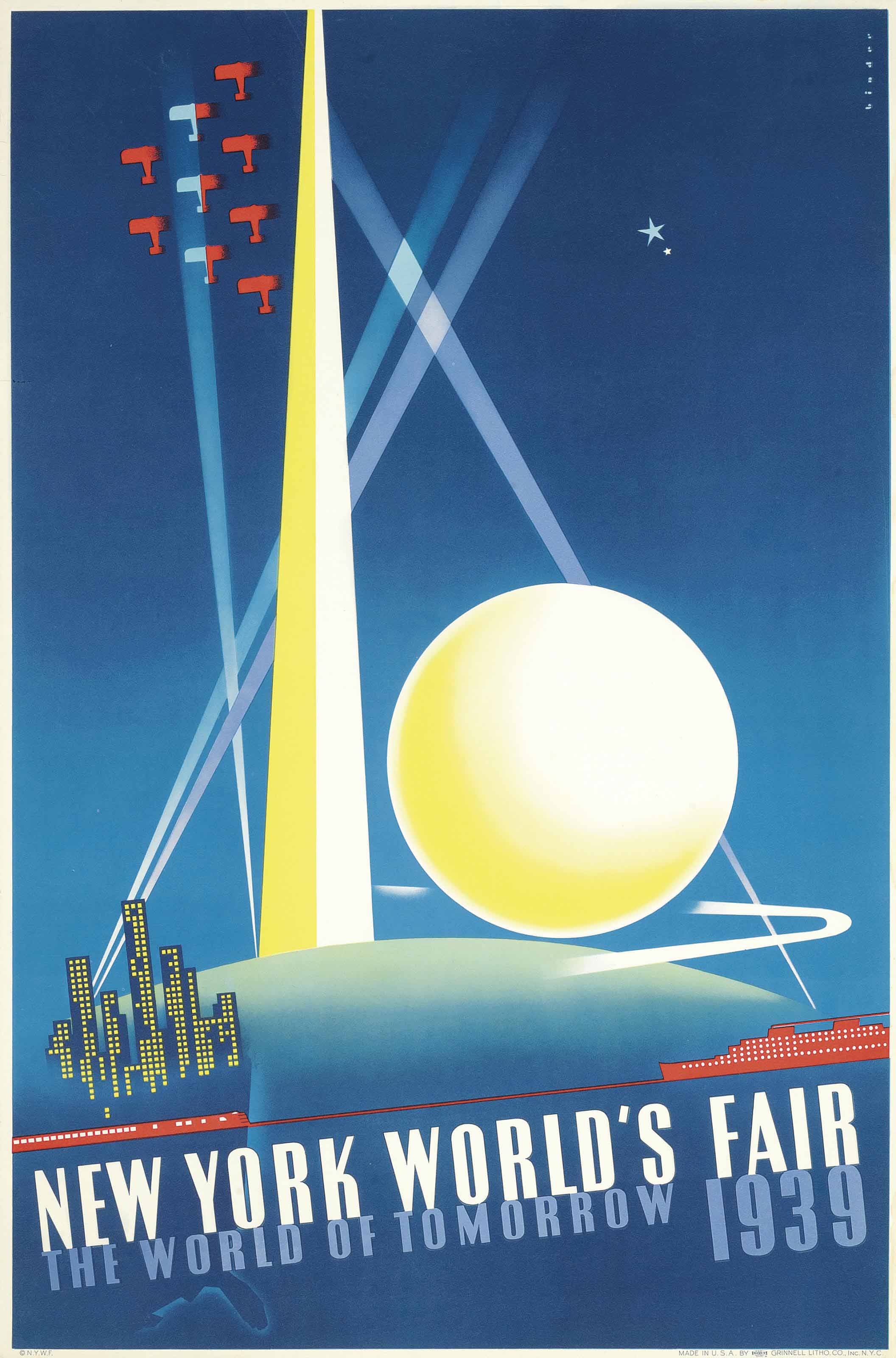
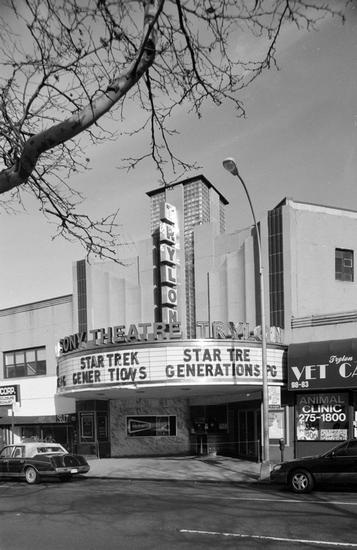
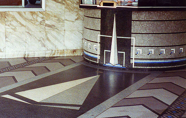
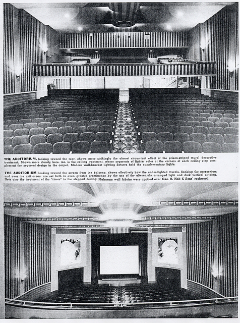
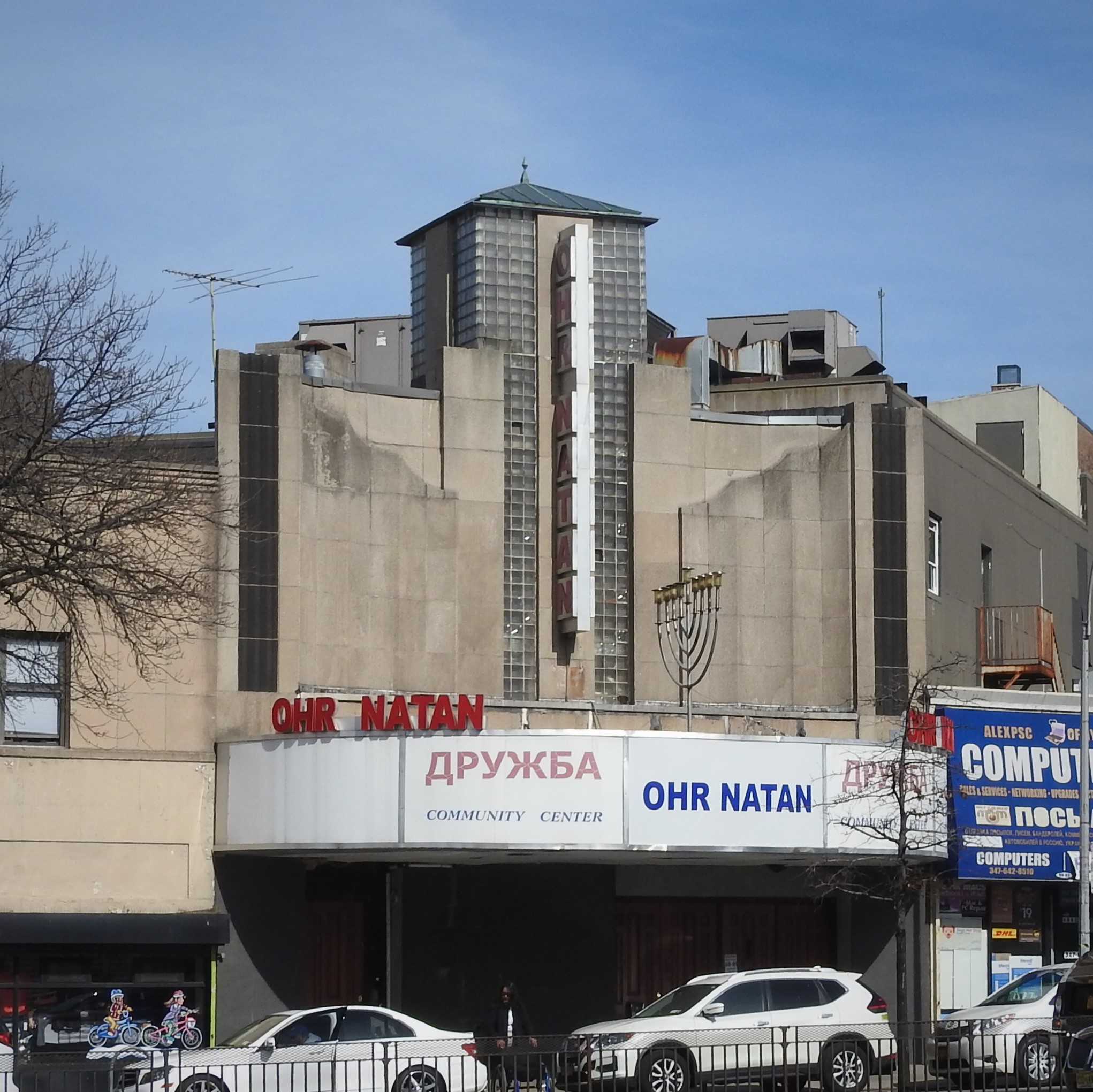
Until 2006, this site was home to the Trylon Theater, named for the spire that became an icon of the 1939 New York World’s Fair.
The entrance had a Trylon-adorned mosaic ticket booth, terrazzo floors, and mosaic tiles in a chevron pattern.
The interior included a fountain and “World of Tomorrow”–themed murals, as well as striated pilasters flanking the stage.
Although it was a popular venue, audiences dwindled over the years and the theater closed in 1999. It was later rented by a Bukharian Jewish organization and became the Ohr Natan Community Center.
The property was sold in 2021 for the construction of Trylon Tower. The new building borrows Art Deco references and pays tribute to the former theater.
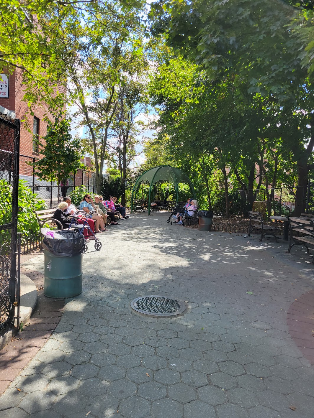
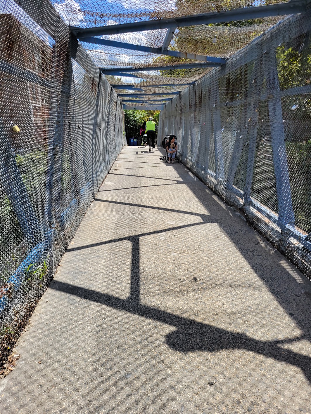
Plaza 67 is a small sitting area at the edge of Rego Park and Forest Hills.
Originally known as the Austin Street Sitting Area, it was reconstructed in 1999 with new fencing and seating, funded by Council Member Karen Koslowitz. Since then it has remained a modest but valued public space for nearby residents.
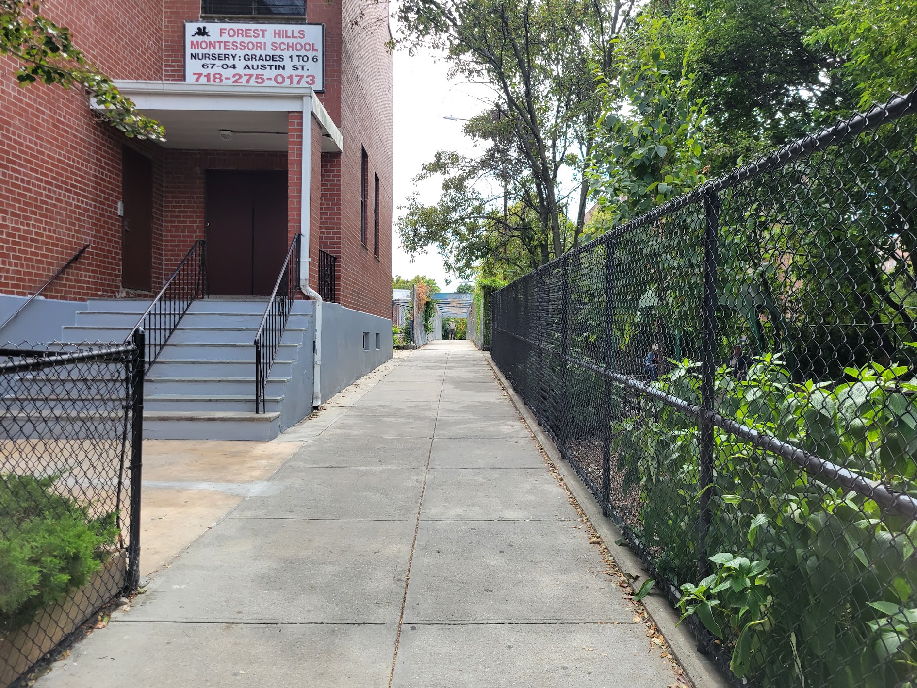
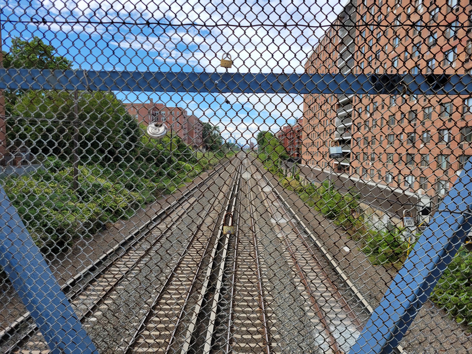
The plaza sits beside the 67th Avenue Pedestrian Overpass, which allows residents to cross over the LIRR tracks.
From the bridge, you can look west and see the tracks extending towards the Manhattan skyline.
On weekend walks, we often pass through Plaza 67 and cross the pedestrian overpass, turning on Burns Street and continuing through parts of Forest Hills Gardens.
This route, linking the rhythms of Rego Park with the historical architecture of Forest Hills Gardens, feels like a small urban pilgrimage.
Photo by Lev Izraelit. Licensed under CC BY-SA 4.0
Photo by Lev Izraelit. Licensed under CC BY-SA 4.0
Outro
It’s not easy to bring a neighborhood tour to a close. Each section asks for maps, images and words, and there is always a feeling that more could be added. Still, this work reflects some of my experience of Rego Park, a story I can share even if it keeps unfolding.
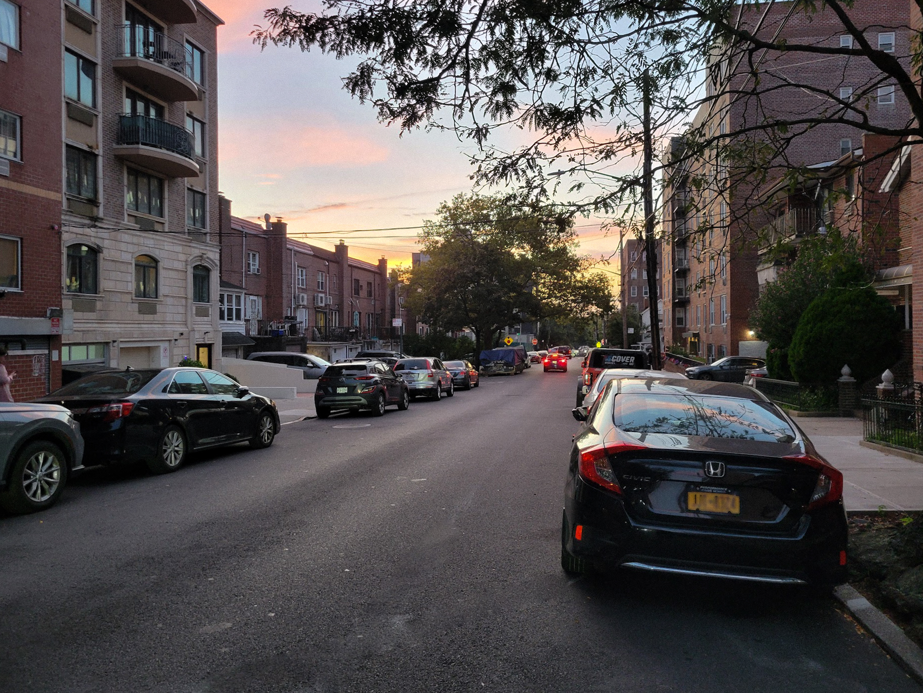
Evenings brush the buildings with pink and orange, and commuters stream back through the streets.
As night arrives, Wetherole Street becomes silent except for the echo of an occasionally passing car - swelling for a moment, then fading.
Living in Rego Park, I was inspired to create this digital tour, drawing on material from Six to Celebrate and other efforts to preserve the neighborhood’s history. More of my work can be found at levizraelit.com.
_01_-_Rego_Center_II.jpg)
_04.jpg)
 © Mapbox © OpenStreetMap
_09_-_Lost_Battalion_Hall.jpg)
 © Mapbox © OpenStreetMap
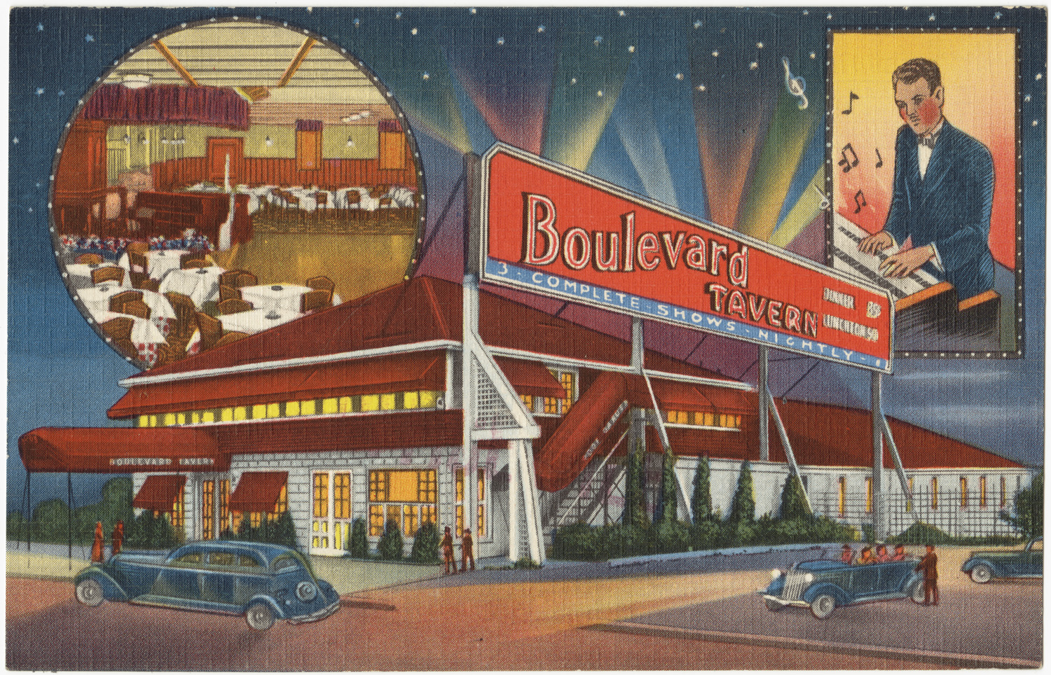
 © Mapbox © OpenStreetMap
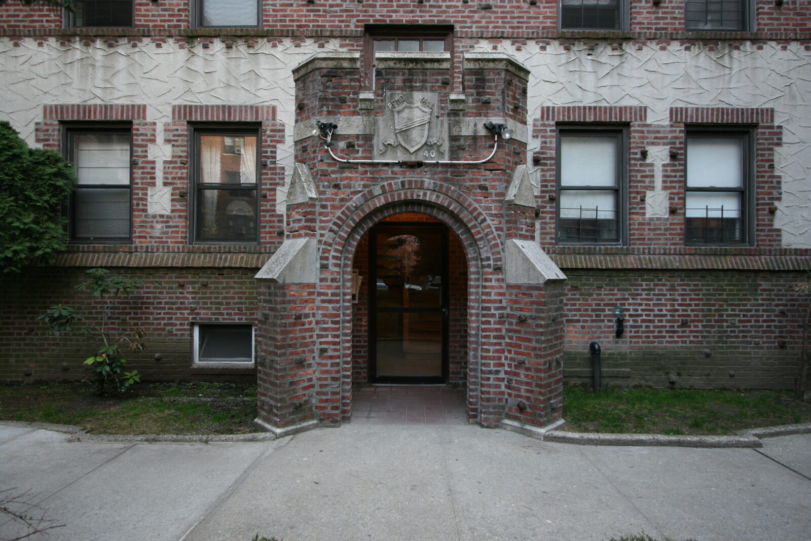
 ©
© 
.jpg)